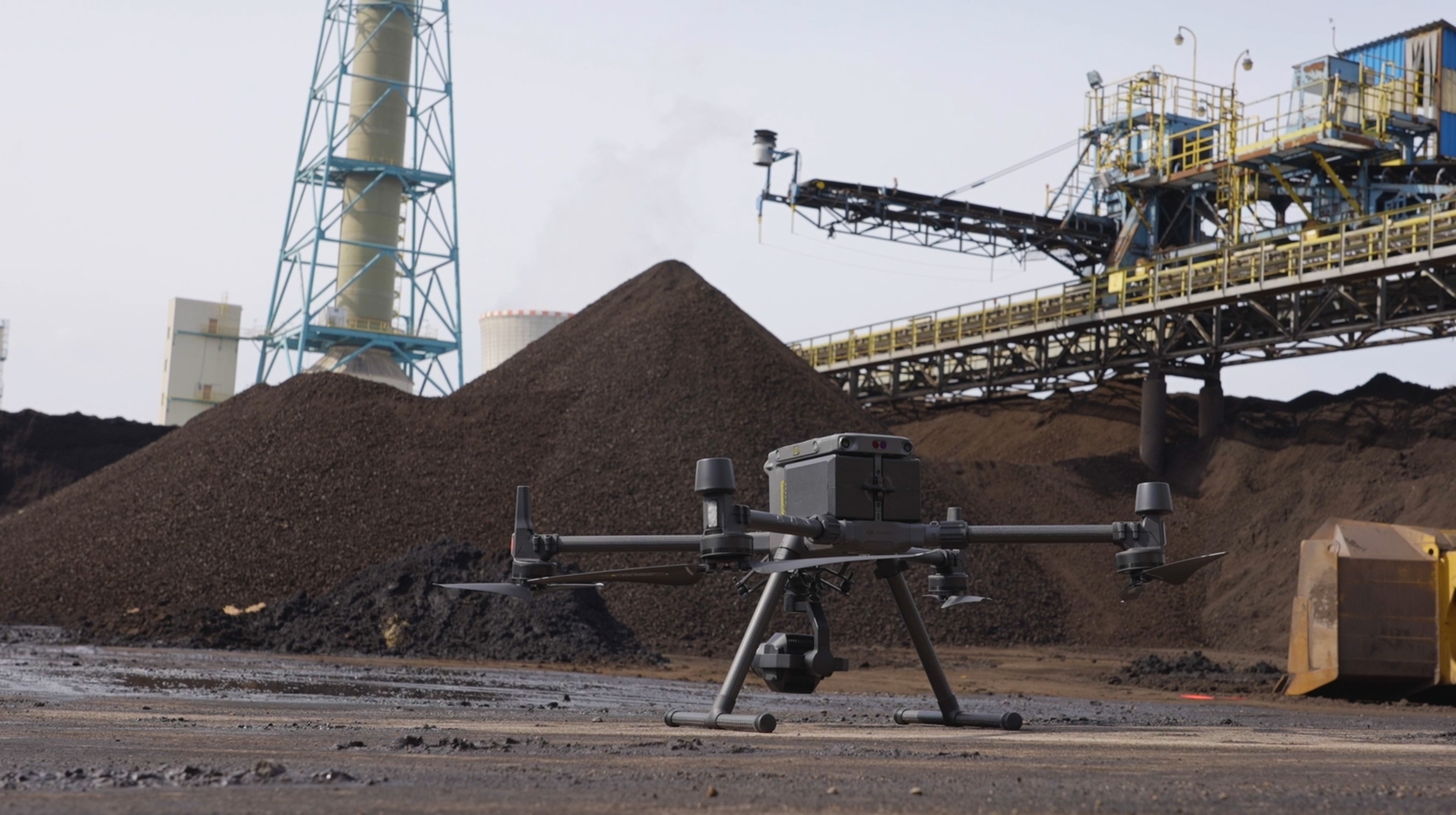
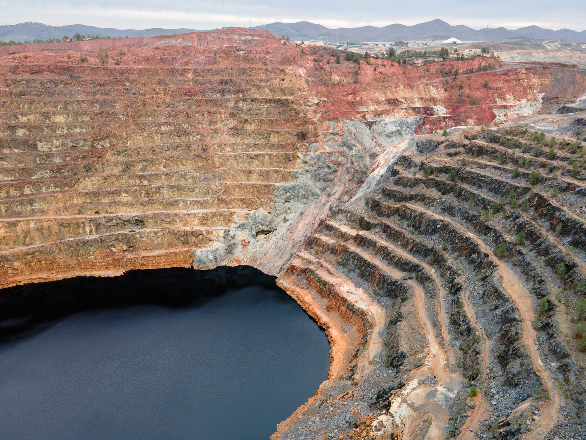
Aerial inspection using drones is fundamental for the management of open-pit mines, providing a macro view and precise data of the entire operation.
Data captured with speed, safety, and precision
The integration of Aerial Inspections in the mining industry results in a safer operation by removing personnel from hazardous environments; a more productive one by providing precise data for planning and control; and a more sustainable one by ensuring regulatory compliance and rigorous environmental monitoring.
Drone & GIS aerial platforms provide high-quality, accurate data for all mapping, monitoring, and inspection requirements in mining, in a safer and more efficient way, without causing downtime in mine operations.
Key Benefits of Using Drones for Inspection and Monitoring in the Mining Industry
ENHANCED SAFETY
Protecting Lives and Assets
At DRONE & GIS, safety is our priority. The main advantage of using drones for inspection and monitoring in the mining industry is the drastic reduction of risks to our staff.
Hazardous tasks, such as monitoring highwall stability, inspecting tailings dams, and checking equipment on active mining faces, can be carried out remotely. This eliminates exposure to high-risk areas, such as rockfalls and proximity to heavy machinery, ensuring a safer and more efficient working environment.
Optimisation and Operational Cost Reduction
The savings generated by the use of drones in mining are substantial and multifaceted. By replacing traditional, time-consuming topographical methods, the technology allows for a drastic reduction in operational and labour costs. Reducing the need for large field teams, especially in extensive and complex areas, is a competitive advantage. Furthermore,
Furthermore, the ability to perform visual inspections and volumetric monitoring without the need to halt active faces or heavy machinery ensures continuous and more efficient operation, optimising the production flow.
SUBSTANTIAL COST REDUCTION AND UNINTERRUPTED OPERATION
PRECISE AND RELIABLE DATA
Superior Quality and Data Analysis
Equipped with a variety of sensors, such as high-resolution cameras, thermal sensors, and LIDAR, our drones capture detailed, georeferenced data crucial for mining. This allows, for example, the early detection of thermal anomalies on conveyor belts, precise monitoring of slope movement, and exact calculation of stockpile and waste rock volumes.
DRONE & GIS delivers highly reliable Technical Reports and precise Digital Terrain and Elevation Models, integrating this data into GIS Tools for Centralised Asset Management and Mine Planning. This enables continuous monitoring of mining progression, the creation of digital inventories, and complex analyses for strategic decision-making.
SERVICES AND APPLICATIONS
Currently, companies worldwide involved in mining activities use drones. The technology has a high degree of applicability for numerous purposes, enabling visual inspections with greater speed, safety, and precision.
Using cutting-edge technology, processes that previously required production shutdowns, scaffolding, and exposing workers to high-risk environments are being replaced by safer, faster, and more precise technological solutions.
Aerial (with drones) and ground (with robots) inspections are the cornerstones of this new era of predictive maintenance and asset management.
High-Performance Inspections: Safety, Speed, and Operational Precision
Topography and 3D Mapping (Aerial Photogrammetry and LIDAR)
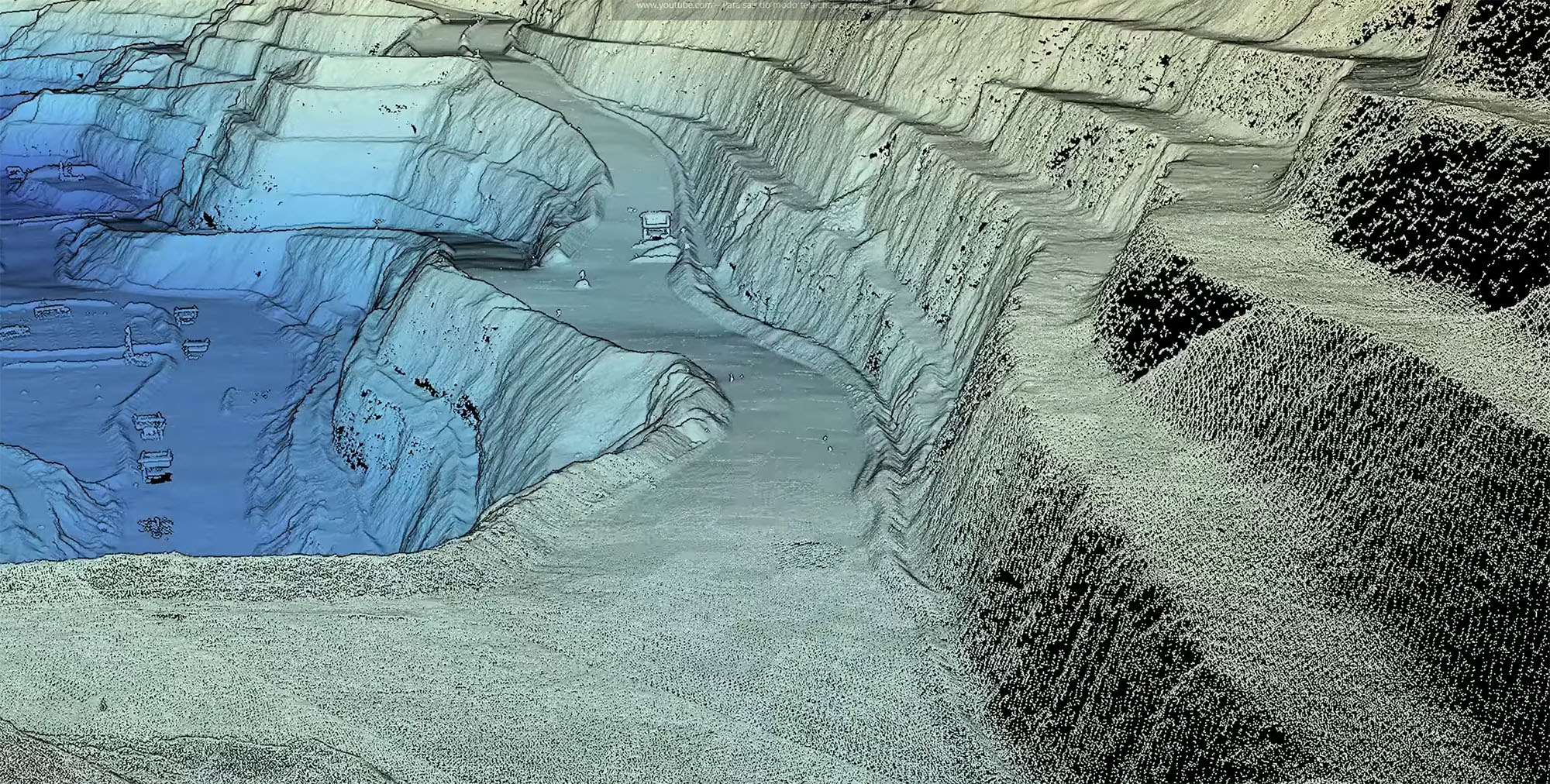
Application: Creation of highly accurate digital surface and terrain models of the entire mine (pits, stockpiles, structures). Replaces traditional surveying, which is slower, more expensive, and exposes surveyors to risks.
Benefits:Basis for all mine planning, monitoring mine progress compared to the design, and optimizing transport roads.
Calculation of Volumes of Piles and Pits
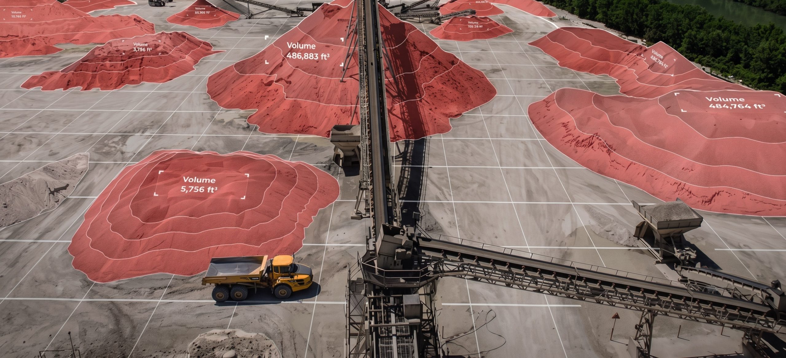
Application: Based on the 3D models, the volume of ore stockpiles (inventory for sale) and waste rock (material moved) can be accurately calculated.
Benefits: Precise production control, reconciliation between planned and executed figures, and cash flow optimization. The accuracy is far superior to conventional methods.
Geotechnical Monitoring of Slopes and Benches
Application: Periodic flights over the pit slopes (walls) to identify displacements, cracks, signs of erosion, and potential instabilities that could lead to landslides.
Technology: LIDAR sensors are ideal for this task, as they generate point clouds with millimeter precision, allowing for comparison of models over time and detection of any subtle movement.
Tailings Dam Inspection
Application: Comprehensive monitoring of the dam structure, including verification of instrumentation (piezometers, surface markers), identification of anomalies, water seepage, erosion processes, and compliance with the requirements of the National Mining Agency.
Benefits: It increases the frequency and quality of inspections, generates a digital record for audits, and helps in the early detection of any abnormal structural behavior, which is vital for safety.
Inspection of Plant Equipment and Structures
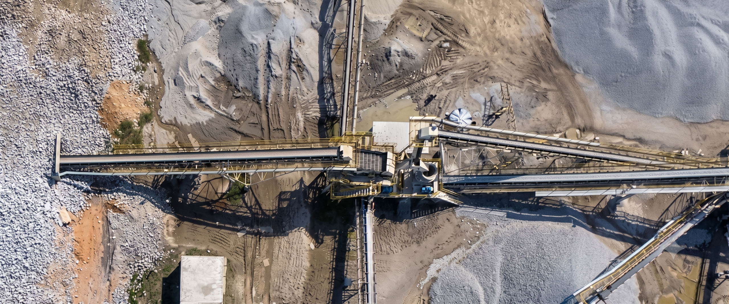
Application: Visual and thermal inspection of conveyor belts, shed roofs, crusher structures, mills, and other processing plant installations.
Technology: High-resolution zoom cameras to detect wear and structural damage. Thermal imaging cameras to identify overheating in conveyor belt rollers or motors.
Inspection and Mapping of Underground Mines and Tunnels
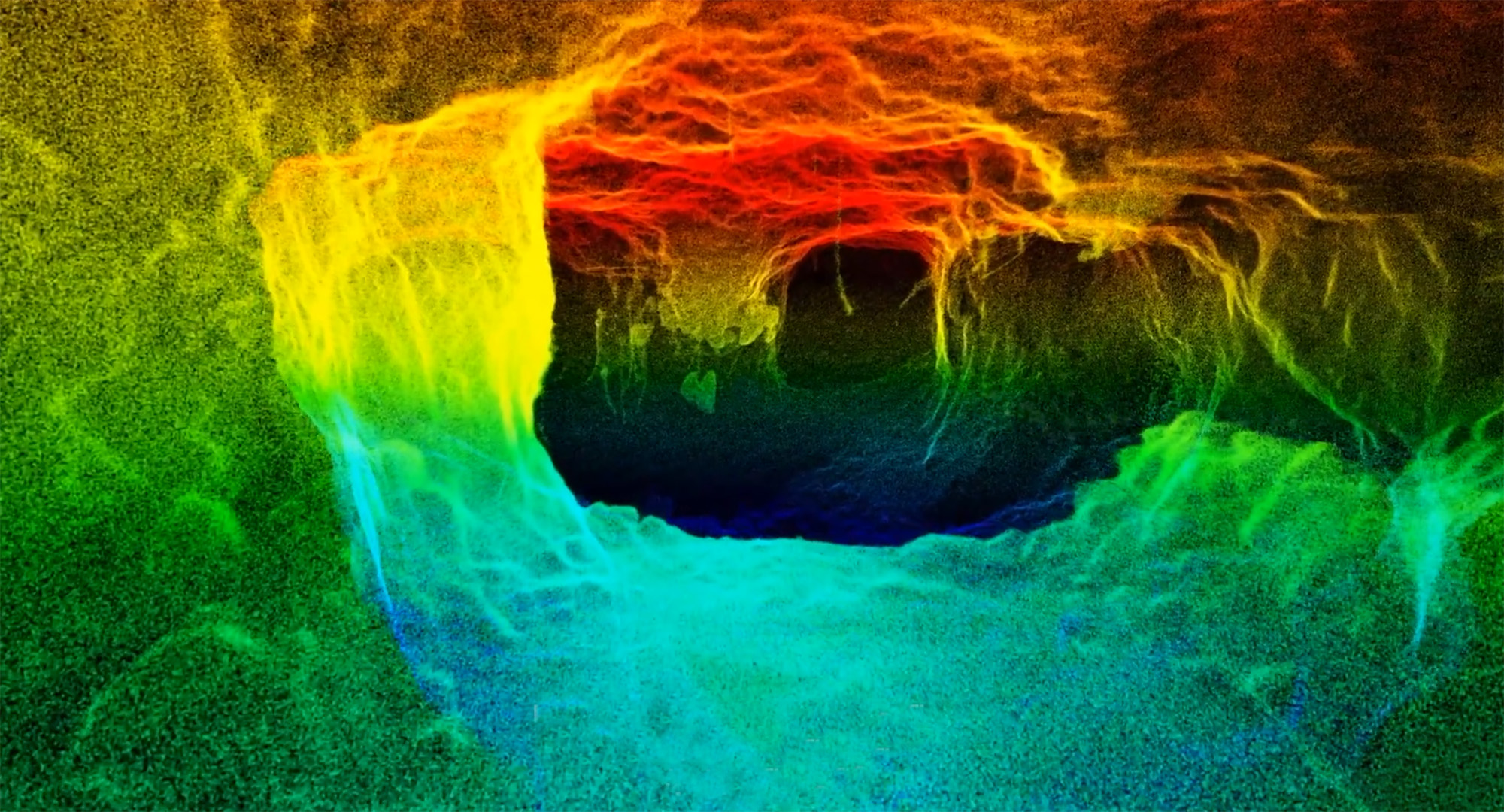
By deploying specific drones for confined space applications, equipped with high-tech sensors (LiDAR, RGB, and Thermal), it is possible to create real-time 3D maps, even in locations without GPS signal and with little or no light. This is vital to:
Assess structural integrity.Identify cracks, fissures, and areas of instability in the walls and ceilings of tunnels and galleries.
Risk monitoring: To map hazardous areas and accumulations of toxic gases, such as methane and carbon monoxide, without exposing workers.
Inspection of old buildings: Safely navigate and inspect abandoned mining areas.
How We Can Help
Get in touch and schedule a consultation with our experts; it will be a pleasure to assist you!