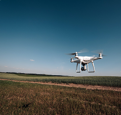
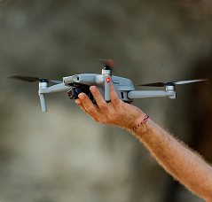
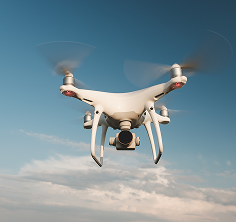
With Drone & Solutions GIS It is possible to utilize the full potential of Geographic Intelligence applied to Precision Agriculture techniques, providing specific analyses and maps to facilitate the understanding and management of agricultural operations.
In a sector where operational efficiency and sustainability are economic and environmental imperatives, the adoption of cutting-edge technologies transcends the concept of innovation to become a strategic pillar.
Our expertise lies in the systemic integration of Geotechnologies, Unmanned Aerial Vehicles, and Artificial Intelligence.AI) to deliver high value-added solutions, converting complex data into surgically precise agronomic decisions.
Advanced image processing and complete management of geospatial data, from planting mapping to crop monitoring.
A DRONE & GIS It uses robust sensors for precise aerial crop diagnostics. The data generates intelligent maps for optimized input applications, irrigation, and plant health monitoring, maximizing efficiency and productivity in the field.
Our solutions convert complex data into precise operational plans, ensuring maximum efficiency and profitability even before the machinery enters the field.
By combining satellite imagery, high-precision drone footage, and the power of Artificial Intelligence, we offer a complete field diagnosis, enabling faster, more efficient, and cost-effective actions.
The integration of Artificial Intelligence (AI) and geotechnologies offers a robust set of tools for monitoring, analyzing, and controlling various stages of the production cycle, from planting to harvesting.
A Precision Agriculture It has evolved into an advanced technological ecosystem, integrating information and innovations for a Smarter and more efficient agricultural management.
This approach goes beyond simply applying inputs or mapping the crop; it encompasses the optimization of all production processes, from planting to harvesting, based on accurate data.
The advancement of technologies such as GPS, remote sensors, and geotechnologies has laid the groundwork for this revolution.
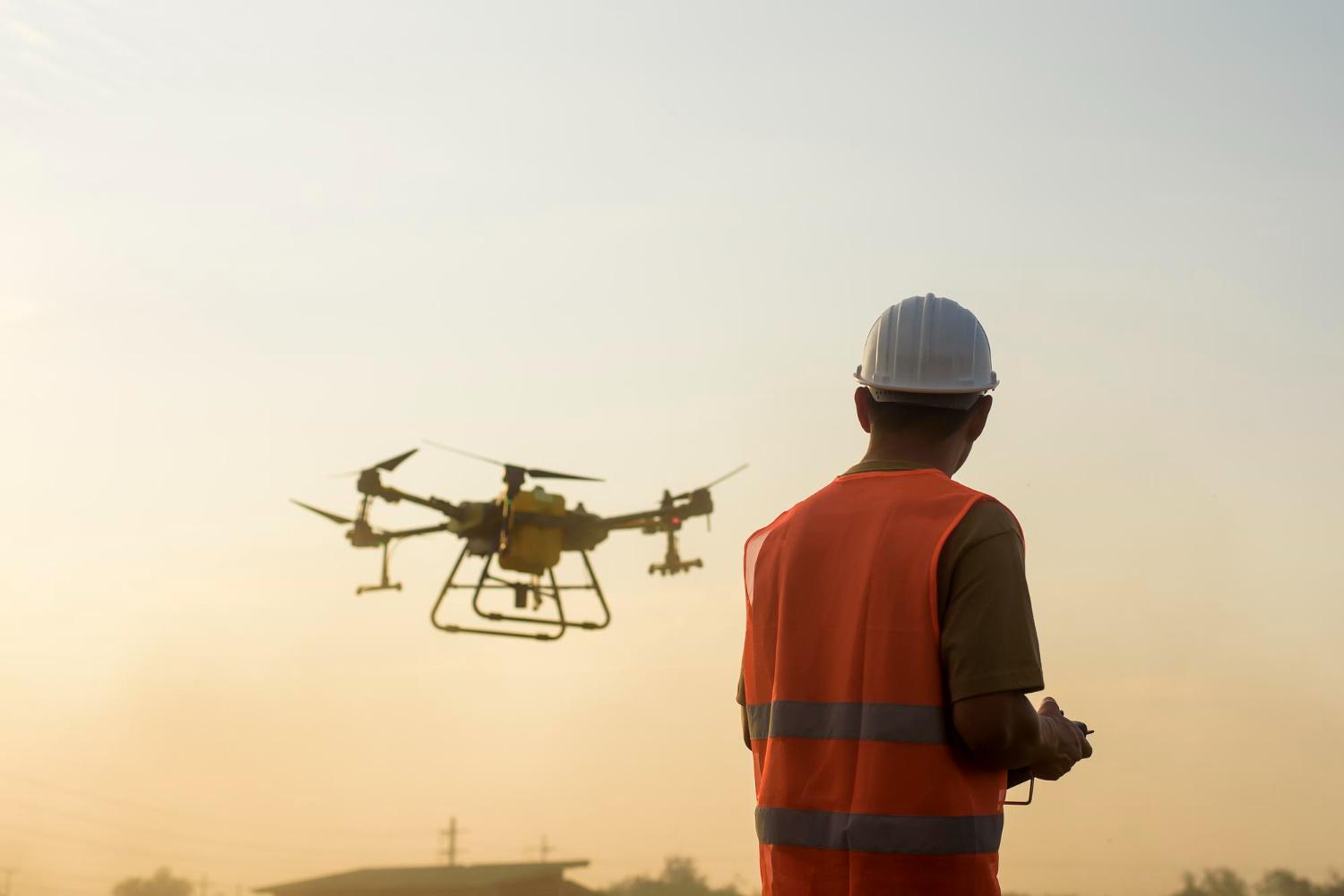
The introduction of drones represented an exponential technological leap for agribusiness.
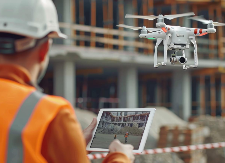
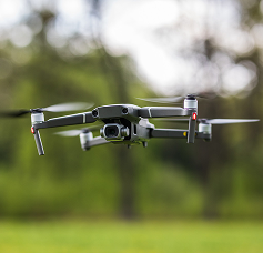
Equipment such as that operated by DRONE & GIS They transformed data collection, enabling quick and detailed scans of vast areas.
Equipped with high-resolution sensors, these drones capture information that would be invisible to the naked eye, revealing variations in vegetation health, water stress, and soil anomalies with unprecedented precision.
However, the true potential of this data is unlocked by IArtificial Intelligence (AI).
This is where the technology of DRONE & GIS What stands out is that the terabytes of images and data collected by the drones are processed by AI and machine learning algorithms.
DRONE & GIS stands out in precision agriculture by integrating drones, advanced sensors, and GIS.
The company's focus is on "Geographic Intelligence," converting geospatial crop data into valuable insights for producers to make more strategic and accurate decisions.
To ensure the positional accuracy of the data, the company uses navigation satellite systems (GNSS) with real-time (RTK) and post-processed (PPK) correction technologies.
The implementation of ground control points, measured with geodetic GNSS receivers, ensures high-precision georeferencing, resulting in cartographic products with errors on the order of centimeters.
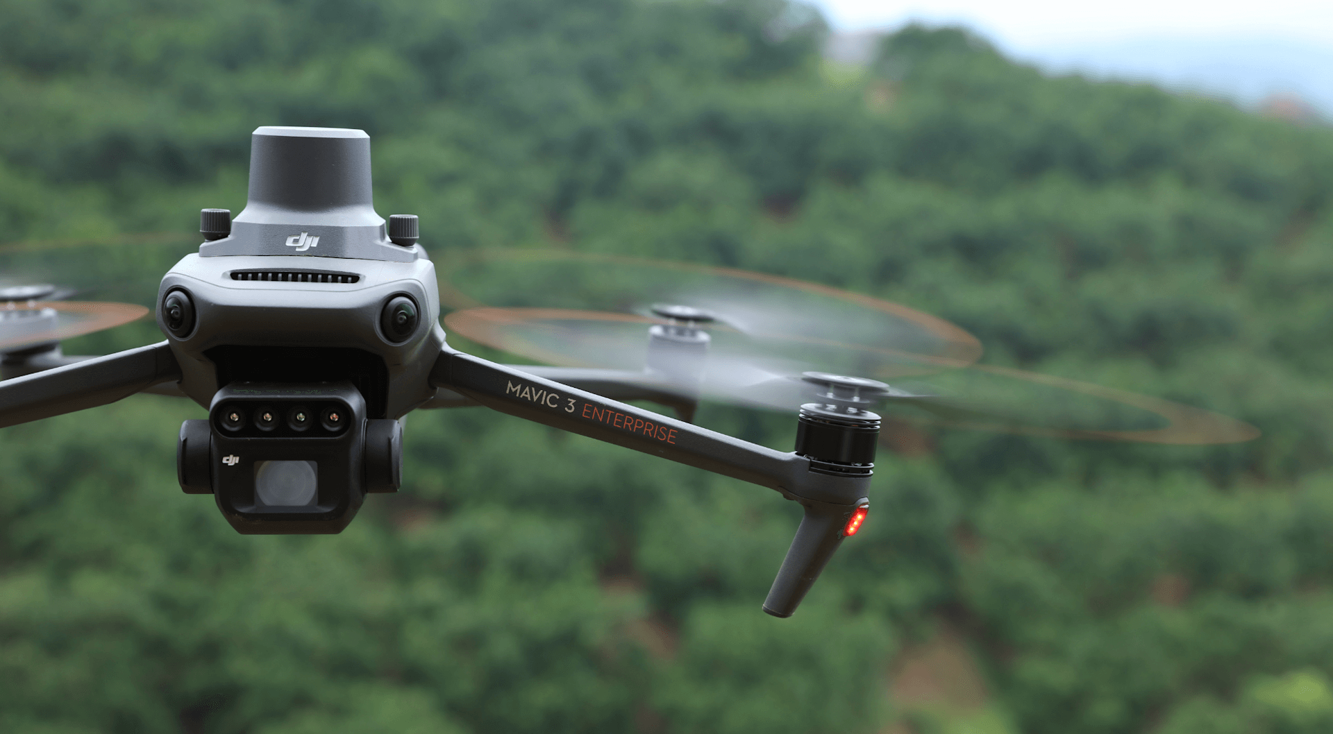
The foundation for any quality geospatial analysis is accurate data collection. DRONE & GIS employs rotary-wing and fixed-wing drones, selected according to the area size and mission purpose.
These aircraft are equipped with sensors >RGB, Multispectral, Thermal and LiDAR state-of-the-art
After acquisition in the field, the raw images undergo a rigorous image processing workflow using specialized software.
This digital aerial photogrammetry process involves complex algorithms that perform image orientation, extraction of homologous points, and generation of a dense, three-dimensional point cloud.
From this cloud, essential cartographic products are derived for agricultural analysis:
A mosaic of georeferenced and orthorectified aerial images, with a very high level of detail. The orthomosaic serves as a precise visual basis for identifying planting failures, counting plants, detecting weeds, and analyzing crop uniformity.
It represents the elevation of all objects above the ground, including vegetation and structures. It is used for precise measurements of plant height, biomass analysis, and crop planning.
A digital model (DEM) is a mathematical representation of the ground surface, without the presence of objects. It is crucial for agricultural planning, allowing for slope analysis, the delimitation of watersheds for hydrological studies, and the planning of earthmoving and terracing projects, optimizing water management and preventing erosion.
Using the data from Using multispectral sensors, DRONE & GIS generates vegetation index maps., which are quantitative indicators of the health and development of crops.
Each index uses a mathematical combination of different spectral bands to highlight specific vegetation characteristics:
NDVI (Normalized Difference Vegetation Index)
What is it?
O NDVI It is, without a doubt, the best known and most widely used vegetation index.
It assesses the vigor of vegetation based on the difference between near-infrared (NIR) light, which healthy vegetation reflects intensely, and red light, which is absorbed by chlorophyll for photosynthesis.
Main Uses:
General monitoring of crop health: Identify areas with water stress, nutritional deficiencies, or pest and disease infestations.
Biomass estimate: Correlate NDVI values with the amount of green mass in the crop.
Identifying planting failures: To detect areas where plants have not germinated or have not developed properly.
Creating variable rate application maps: Optimize the application of fertilizers and pesticides, applying them only where necessary.

NDRE (Vegetation Difference Index)
(Normalized Red Border)
What is it?
To overcome the limitation of NDVI saturation in crops with dense canopies, the following is used: NDRE. This index uses the "Red Edge" band, a region of the electromagnetic spectrum sensitive to variations in chlorophyll content.
Main Uses:
Monitoring crops at an advanced stage: Ideal for crops such as corn, sugarcane, and forests, where NDVI can become saturated.
Evaluation of chlorophyll and nitrogen content: NDRE has a strong correlation with chlorophyll concentration in leaves, which in turn is linked to the plant's nitrogen status.
Detection of subtle stress: Because it is more sensitive to variations in chlorophyll, NDRE can detect signs of stress before they are visible in NDVI.
SAVI (Soil-Adjusted Vegetation Index)
What is it?
Main Uses:
Analysis of early-stage crops: To obtain a more accurate assessment of the vigor of young plants, without the interference of exposed soil.
Monitoring areas with sparse vegetation: Ideal for crops such as vineyards or in semi-arid regions.
Plant count: Reducing ground noise makes it easier to identify and count individual plants.
EVI (Enhanced Vegetation Index)
What is it?
O EVI It is another index that seeks to improve upon the NDVI, being more sensitive to variations in areas of high biomass and correcting for atmospheric and soil influences. To do this, it incorporates the blue light band into its calculation.
Main Uses:
Monitoring of forests and dense crops: Its lower saturation in high biomass makes it ideal for these applications.
Phenology studies: To track seasonal changes in vegetation development with greater precision.
Long-term analyses: Because it is less susceptible to atmospheric noise, EVI is more reliable for comparing images from different dates.
GNDVI (Vegetation Difference Index)
Standardized Green)
What is it?
O GNDVI It is similar to NDVI, but uses the green band instead of the red one. This makes it more sensitive to variations in chlorophyll concentration than NDVI.
Main Uses:
Estimated chlorophyll and nitrogen content: Like NDRE, GNDVI is a good indicator of the plant's nutritional status with respect to nitrogen.
Detecting stress in its early stages: Its sensitivity to chlorophyll allows for the early identification of problems.
Monitoring crops in intermediate to late stages: It offers a good alternative to NDVI when the latter starts to become saturated.
The generated products (orthomosaics, DEMs, vegetation index maps) are integrated into a Geographic Information System (GIS).
In this environment, data is analyzed, overlaid with other layers of information (such as soil fertility maps, data from previous harvests, etc.) and transformed into actionable intelligence.
Applications include:
Creation of Management Zones
Identifying areas with different productive potentials for the application of inputs at variable rates.
Prescription Maps
Generating files compatible with variable-rate agricultural machinery (sprayers, fertilizer distributors), optimizing the use of inputs, reducing operating costs, and minimizing environmental impact.
Detection of Water Stress
and Nutritional
Analysis of vegetation indices to identify areas with deficiencies early, allowing corrective actions to be taken before productivity is compromised.
Seasonal Analyses and
Multitemporal
Comparing data from different harvests to identify patterns, evaluate the effectiveness of management practices, and improve planning for future cycles.
Precision agriculture, a fundamental pillar of modern agribusiness, intrinsically depends on the collection and analysis of accurate, real-time data. In this scenario, sensors emerge as crucial tools, enabling producers to make more informed decisions, optimize resource use, increase productivity, and promote sustainability.
Next, we detail the main types of sensors embedded in our drones for applications in agribusiness.
High-Resolution Orthomosaic
RGB (Visible Light) Sensors
These are high-resolution cameras, similar to those we use every day. Although they don't capture information beyond the visible spectrum, they are extremely useful for various applications in agribusiness.
Applications:
3D Mapping and Modeling.
Plant Count.
Detecting Planting Failures:
Visual Inspection:
Digital Surface Model (DSM)
Multispectral Sensors
These are the most widespread sensors in precision agriculture. Multispectral cameras capture the reflectance of light in different bands of the electromagnetic spectrum, including visible (RGB) and near-infrared (NIR).
Applications:
Monitoring crop health.
Identification of water and nutritional stress.
Pest and disease detection.
Productivity estimate.
Optimizing the application of fertilizers and pesticides at variable rates.
Digital Terrain Model (MDT)
Thermal Sensors (Thermal Infrared)
Thermal cameras measure the long-wave infrared radiation emitted by objects, which is directly related to their surface temperature.
A plant under water stress transpires less, which raises the temperature of its leaves. Thermal sensors can detect these small temperature variations before stress symptoms become visible.
Applications:
Irrigation Management
Disease Detection
Animal Monitoring
UseWe use artificial intelligence and geospatial data analysis to transform your crop planning.
Our solutions convert complex field data into precise operational plans, ensuring maximum efficiency and profitability even before the machinery enters the field.
Optimize your operation even before starting the engine.
The success of your crop starts with the perfect layout. The team at DRONE & GIS It uses advanced algorithms that analyze data on altitude, soil type, and your machinery specifications to design the most efficient planting lines possible.
Our goal is clear: maximize productive area, reduce fuel consumption, and eliminate unnecessary maneuvers, saving valuable time and resources.
Planting Line Maps
High Precision
Customized projects in multiple formats (contour lines, optimized straight lines, through-level contours) to adapt to your specific needs.
Comparative Scenario Analysis
We present different planting strategies with clear efficiency statistics (planted area, maneuvering time, distance traveled), allowing you to choose the best cost-benefit option.
Guaranteed Compatibility
We deliver the 100% files ready for import into your planter's autopilot (GPS) and monitor, ensuring perfect execution in the field.
Protect your assets, ensure the future productivity.
The land is your most valuable asset. A DRONE & GIS Develops terracing and conservation projects designed with high precision for your area.
Using advanced hydrological models, historical rainfall data, and high-definition topography, we create systems that control erosion, maximize water infiltration, and ensure the sustainability of your soil for future harvests.
Zooming in on the detail that solves the problem. Problems and saves your productivity.
When decisions need to be made with speed and surgical precision, the DRONE & GIS puts our high-resolution drones into the field..
This aerial diagnostic tool is the ultimate solution for day-to-day operational management, providing actionable data to quickly, efficiently, and cost-effectively resolve localized problems.
Complete Project of
Terracing
Design and layout of level or gradient terraces, in accordance with technical standards and the needs of your plot.
Detailed Hydrological Analysis
Report proving the project's water retention capacity, ensuring effective control of surface runoff.
Construction Planning
We provide the exact volume of earthmoving (cut and fill), allowing for precise budgeting and an efficient construction schedule.
Plant intelligently, save money. each line.
Why waste seeds where machines will pass? With our traffic optimization application, the We mapped the routes of sprayers and harvesters in advance.
This intelligence generates a planting plan that automatically shuts off planter sections in areas likely to be compacted, resulting in a more uniform final stand and significant savings on inputs.
Planting Map with Lines
Shutdown
A file ready for your autopilot, which performs seed saving automatically and accurately, without operator intervention.
Potential Economy Report
Detailed estimate, in sacks and in reais (Brazilian currency), of the seed savings that will be obtained in each plot, showing the return on investment.
Full Integration
The project is designed to be compatible with pesticide application maps and other post-planting operations, creating a cohesive controlled traffic system.
Transform raw data into competitive intelligence
Your farm is an inexhaustible source of data. We process, organize, and extract value from this information.
We integrate and correct soil maps, elevation data, satellite imagery, harvest maps, and historical data to create a Digital Twin of your field.
This robust and accurate database becomes the foundation for all management and planning decisions.
Diagnosis and Validation of
Geospatial Data
Cleaning and processing all layers of your information to ensure consistency and reliability.
Digital Elevation Models
(High Resolution DEM)
We created an accurate 3D representation of the terrain, which is fundamental for any spatial analysis.
Terrain Intelligence
We deliver maps of slope, hillside orientation, water flow, and management zones, revealing insights that are not visible to the naked eye and that guide the optimized management of inputs.
Our platformAforma integrates continuous monitoring of your crops with intelligent management tools.
We collect and process data from multiple sources (satellites, drones, and sensors) so that you can not only identify problems in advance, but also make the best strategic and operational decisions, optimizing resources and maximizing productivity in each plot.
From macro to micro: the intelligence that directs your decisions.
Strategic management requires a broad and constant vision.
With continuous monitoring of DRONE & GIS, With this system, you can monitor the health and development of your crops via satellite, without leaving the office.
Our Artificial Intelligence algorithms process these images to reveal what is happening in the field, allowing you to compare performance between plots, optimize your team's time, and direct investigations to the points that really matter.
Vegetative Vigor Diagnosis
(NDVI and other indices)
Identify crop variability to manage field investigations and prioritize areas that need attention.
Anomaly Detection with AI
Our algorithms alert us to anomalies and stress zones, enabling proactive management of nutritional, water, or phytosanitary problems.
Creation of Management Zones
Optimized
Transform the identified variability into smart management zones, the basis for more efficient and sustainable input management.
Input Management at Rate
Variable
We provide accurate prescription maps for your fertilizer, seed, and other input management, applying the right dose in the right place and reducing costs.
Zooming in on the detail that solves the problem. Problems and saves your productivity.
When decisions need to be made with speed and surgical precision, the DRONE & GIS puts our high-resolution drones into the field..
This aerial diagnostic tool is the ultimate solution for day-to-day operational management, providing actionable data to quickly, efficiently, and cost-effectively resolve localized problems.
Initial Booth Management
We perform plant counting and distribution analysis with an accuracy greater than 98%. Make replanting decisions based on data, not assumptions, and ensure productive potential from the start.
Mapping for Management
Weed Control
We identify and classify weed infestations to generate ultra-localized spraying maps. The result is a drastic reduction in herbicide use, savings on inputs, and less environmental impact.
Phytosanitary Management of
Precision
We detect pest and disease outbreaks in their early stages, allowing for precise control before the infestation spreads and compromises productivity.
Pre-Harvest Analysis and
Productivity Estimate
Have reliable productivity estimates on hand for each plot or management zone. Plan all your harvesting, transportation, storage, and sales strategy logistics in advance.
We've elevated agricultural management to a new level.Love, intelligence, and efficiency.
Our digital ecosystem transforms the large volume of data captured by drones into strategic and actionable insights.
EBy employing advanced Computer Vision and Machine Learning algorithms, we enable precise auditing, rigorous quality control, and continuous optimization of operations, transforming the production cycle into a data-driven process focused on maximizing productivity and profitability.
Our solution utilizes aAdvanced Computer Vision Algorithmsl and Deep Neural Networks (Deep Learning).
These models are trained to detect, classify, and vectorize linear crop patterns with sub-meter precision, based on high-resolution orthomosaics obtained by drones.
Deliverable Data: The process culminates in the generation of geospatial vector files, fully compatible and ready for integration with the main agricultural management and machinery systems on the market. Interoperability is a fundamental pillar of the deliverable.
Practical Application and Value Creation: The generated vectors are imported directly into the autopilot systems of harvesters, tractors, and sprayers, functioning as highly accurate guidelines. The generated value is multifaceted:
Absolute Precision in Operation: It ensures that the machinery faithfully follows the original planting path, eliminating the need for the operator to create new rows and mitigating deviations and human errors.
Drastic Reduction of Losses: The direct consequence is the significant reduction in trampling of stubble (in the case of sugarcane) or the crushing of adjacent plants in other crops.
Maximizing Productivity and Longevity: Preserving the structure of the plot translates into a direct increase in productivity (tons per hectare) and extends the lifespan of the sugarcane field, allowing for a greater number of harvests.
Operational Efficiency: It optimizes machinery performance, allowing it to operate at higher speeds and with greater safety, reducing fuel consumption and operating time per area.
Based on high-resolution images captured by our drones, Our platform uses proprietary Machine Learning algorithms., based on semantic segmentation and object classification.
This technology allows us to distinguish with centimeter precision the vegetation that has emerged from any type of gap, automatically classifying them by size and pattern of occurrence.
Deliverables of Agronomic Intelligence:
Fault Diagnosis Map: We deliver a highly accurate georeferenced thematic map that reveals not only the location and geometry, but also the linear footage or exact area of each fault.
Operational Performance Dashboard: A strategic management dashboard with KPIs (Key Performance Indicators) that allow for in-depth analysis, including:
Strategic Value for Your Operation:
Fault Diagnosis Map: Our data allows us to clearly identify the source of the problems, whether it's a mechanical failure in the planter, problems with input distribution, inferior seed/seedling quality, or early pests.
Precise and Intelligent Replanting The gap maps are exportable and compatible with major precision agriculture platforms, guiding spot replanting operations. This ensures the recovery of the ideal stand with maximum efficiency.
Resource Optimization: Eliminate waste. Use resources (seeds, seedlings, fertilizers) and labor only in areas that truly require intervention.
Guarantee of Productive Potential: By ensuring a uniform and gap-free stand, DRONE & GIS helps you guarantee that every hectare of your farm reaches its maximum productive potential and the expected financial return.
In high-performance farming, perfect parallelism is an indispensable prerequisite for the efficiency and safety of mechanized operations.
To theDrone & GIS Parallelism Audit Solution It offers definitive validation of the geometric quality of your planting.
Our technology calculates the exact perpendicular distance between adjacent rows at thousands of checkpoints per hectare, generating a robust statistical model and a high-fidelity visual representation of the entire field.
Precision Deliverables:
Spacing Variation Heatmap: We deliver a high-definition heat map that illustrates, with an intuitive color scale, compliance zones and critical areas of bottleneck (collision risk) or excessive widening (idle space).
Detailed Statistical Report: We provide a complete technical report with the statistical distribution of spacings, indicating values. averages, standard deviation, EOPThe exact percentage of the area that falls outside the operational tolerance pre-established by your team.
Value Generated and Strategic Application:
Validation and Calibration of Autopilot Systems (RTK): Our maps serve as an accurate diagnostic tool to validate the performance of geolocation systems and guide fine-tuning, ensuring the expected centimeter-level precision.
Prevention of Losses and Material Damage: It allows for the proactive identification of areas with an imminent risk of plant/stump crushing by machine track widths, in addition to reducing the risk of damage to tires and mechanical components.
Traffic Optimization and Compression: It ensures that the machine traffic plan is executed perfectly, optimizing operational flow and contributing to intelligent soil compaction management.
Continuous Process Improvement (PDCA): The report provides valuable historical data that fuels the continuous improvement cycle, allowing each crop to be planted with superior quality to the previous one.
Our solution elevates agronomic management to a level of absolute precision., converting the traditional booth count into a complete digital census, eliminating the uncertainties and high margins of error of manual sampling.
Our Object Detection models are rigorously trained for a wide variety of crops, capable of detecting, segmenting, and counting each species individually, even under conditions of partial overlap or variable lighting.
Data Intelligence Generated:
Strategic Value for Your Operation:
Quality Audit: It provides an unbiased and accurate report to audit the performance of the planting process (planter quality, speed) and the actual emergence rate (seed establishment) of different seed lots or brands.
Fundamentals of Predictive Modeling: The actual plant count is the primary and most critical data point for feeding yield forecasting models. Accurate input data is the foundation for any reliable crop estimate.
BBase for Variable Rate Precision Handling: The density map is the first layer of intelligence for creating management zones, allowing for fine-tuning and variable-rate application of nitrogen fertilizers and other inputs throughout the cycle.
At DRONE & GIS, we understand that visual identification of crop stresses usually occurs when the productive damage is already partially or totally irreversible.
Our technology enables Diagnosing the physiological health of plants and detecting anomalies weeks before they become noticeable to the naked eye.. We employ state-of-the-art multispectral sensors that capture crop reflectance in non-visible bands.
This data is processed by our algorithms to generate a range of Vegetation Indices, each with a specific diagnostic purpose.
Physiological Intelligence Deliverables:
Diagnostic Maps by Vegetation Indices: We deliver visual reports that represent the spatial variability of photosynthetic activity, nutritional status, and crop stresses.
Maps of Management Zones and Smart Scouting: We segmented the crop into high, medium, and low performance zones, allowing for... field investigation (sTargeted, efficient, and data-driven reporting.
Temporal Variability Analysis: With recurring flights, we generate comparative analyses that monitor crop development, validate the effectiveness of interventions, and track the expansion or contraction of anomalies.
Strategic Applications and Value Creation:
Early Detection of Stress: Identification of anomalies caused by water, nutritional (especially nitrogen deficiency), phytosanitary (pest or disease attacks) or physical (soil compaction) factors.
Optimization of Agronomic Sampling: It directs the collection of soil and leaf tissue samples to locations that are truly representative of the variability of the plot, resulting in more accurate laboratory analyses and more effective recommendations.
BBase for Variable Rate Prescriptions (VRT): Our maps are the main input for creating variable-rate application prescriptions for fertilizers (especially nitrogen topdressing), growth regulators, ripening agents, and other inputs, optimizing use and maximizing return on investment.
Our solution allows for the identification and mapping of infestations with centimeter precision, generating the necessary intelligence for truly selective spraying.
Our platform uses advanced algorithms to identify and differentiate, pixel by pixel, the target crop from a wide spectrum of weed species (broadleaf and narrowleaf) at different stages of development.
Deliverables for Immediate Action:
Prescription Map for Intelligent Spraying (VRA/Spot-Spray): We generate files in industry-standard formats (e.g., Shapefile), fully compatible with the main sprayer systems equipped with variable rate controllers, section control, spot-spray control, and spraying drones.
MapDensity and Distribution of Infestation: A thematic map that classifies areas by infestation level (low, medium, high). This tool is crucial for strategic analysis, allowing for an understanding of weed dispersal dynamics and the planning of long-term management actions.
Value Generated (Economic, Agronomic and Environmental):
Massive Economic Efficiency: Localized application reduces herbicide consumption at rates that can exceed 90%, depending on the infestation level. This translates into a drastic reduction in operating costs, with a return on investment (ROI) often achieved in a single application.
Agronomic Sustainability: By applying the pesticide only where necessary, we mitigate the risk of phytotoxicity to the main crop and, fundamentally, reduce selection pressure, delaying the development of herbicide-resistant weeds.
ReEnvironmental Responsibility (ESG): The solution promotes a drastic reduction in the chemical load in the environment, decreasing the impact on soil, water, and biodiversity. It is an essential tool for producers seeking certifications and alignment with the best and most modern agricultural practices.