








We offer the most robust solutions on the market for monitoring and inspecting technical infrastructure. Through agile methodologies and a team of qualified experts, we transform aerial and terrestrial data into geospatial intelligence.
The result? Safer decisions, technical compliance, and maximum efficiency for your business.
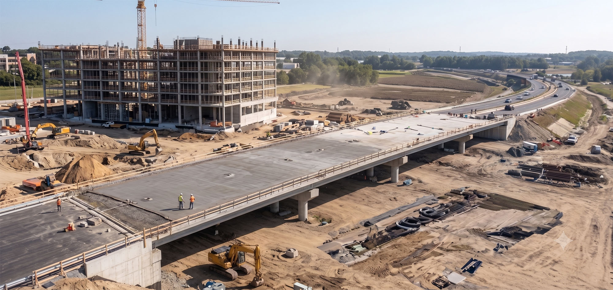
With our expertise and cutting-edge equipment, verification takes on a new dimension, allowing for analyses that would be time-consuming, dangerous, or unfeasible using traditional methods. Drone verification, complemented by ground inspections, focuses on:
When discussing inspection services using drones, the theme of Quality unfolds into several layers, all crucial to the success and longevity of projects. Essentially, it is about ensuring that every stage and every constructed element reaches the highest standards of excellence and compliance.
Monitoring is key to the control, safety, and efficiency of any project. When we combine this concept with drone technology and the support of on-site inspections, monitoring becomes a powerful tool, offering a continuous and detailed view of the progress and health of a construction project or asset.
In the Civil Construction and Infrastructure sector, Planning is the foundation of any successful project. When we introduce our technology, planning acquires an even more sophisticated strategic layer, optimising all stages, from conception to the delivery and maintenance of a site.
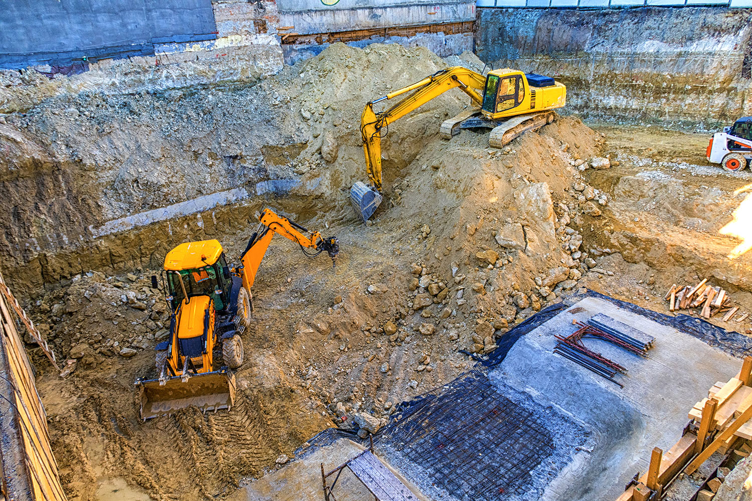
Feasibility Analysis and Site Study: They provide a panoramic and detailed view of the project site, even in hard-to-reach areas. It is possible to analyze aspects such as sunlight throughout the day, proximity to water resources, environmental preservation areas, and identify the best locations for construction.
Topographic Surveys and Detailed Mapping: Our drones, equipped with high-resolution and precision cameras, can map large areas quickly. The collected images are processed in photogrammetry software to generate highly accurate cartographic products, helping to reduce costs and time in the initial surveying phase.
Risk Management and Security: In planning, our drones can be used to identify and map risk areas on construction sites or in existing infrastructure (unstable slopes, areas with potential for falling materials, hard-to-reach locations).
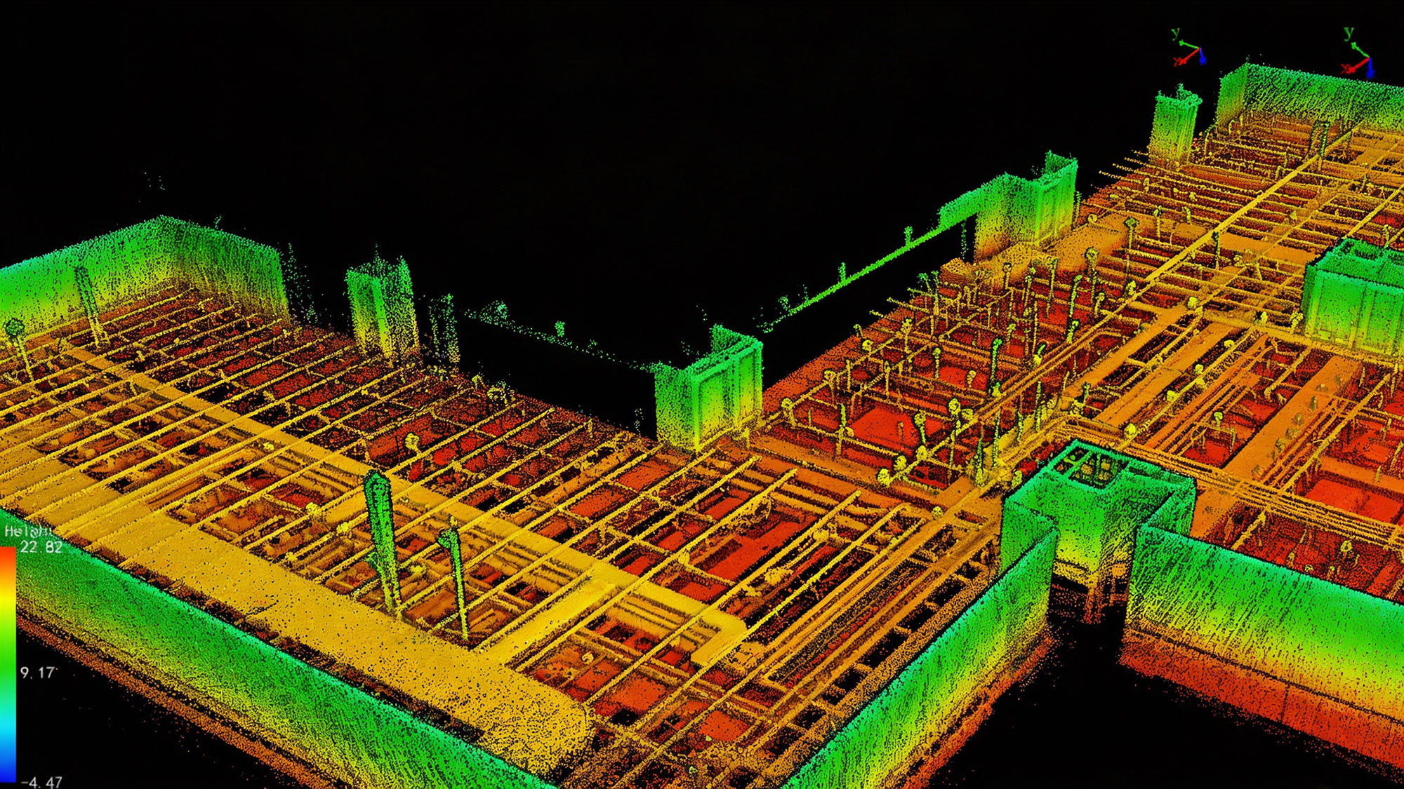
Digital Twin Generation: The collected three-dimensional data can be integrated into BIM platforms. This creates a "digital twin" of the building, a precise virtual replica that can be used to simulate the project at different stages. It allows for collaborative planning, the detection of clashes between different disciplines (architecture, structure, installations) before construction begins, and the simulation of construction scenarios, optimizing workflows and avoiding costly rework.
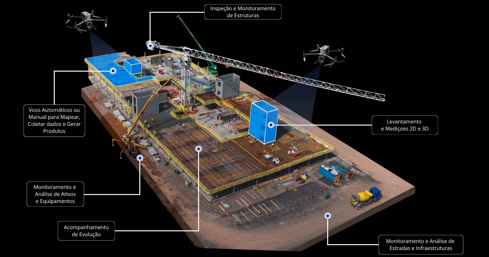
Achieve maximum efficiency and safety in your Civil Construction and Infrastructure projects with our expertise. We offer integrated Inspection and Monitoring solutions, employing state-of-the-art equipment. Our highly qualified team, combined with market-leading and proven reliable equipment, ensures you have accurate data to optimize processes and make strategic decisions at every stage of your project.
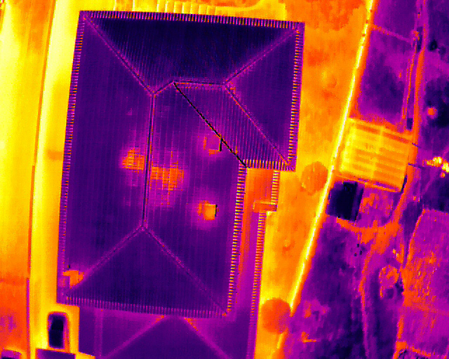
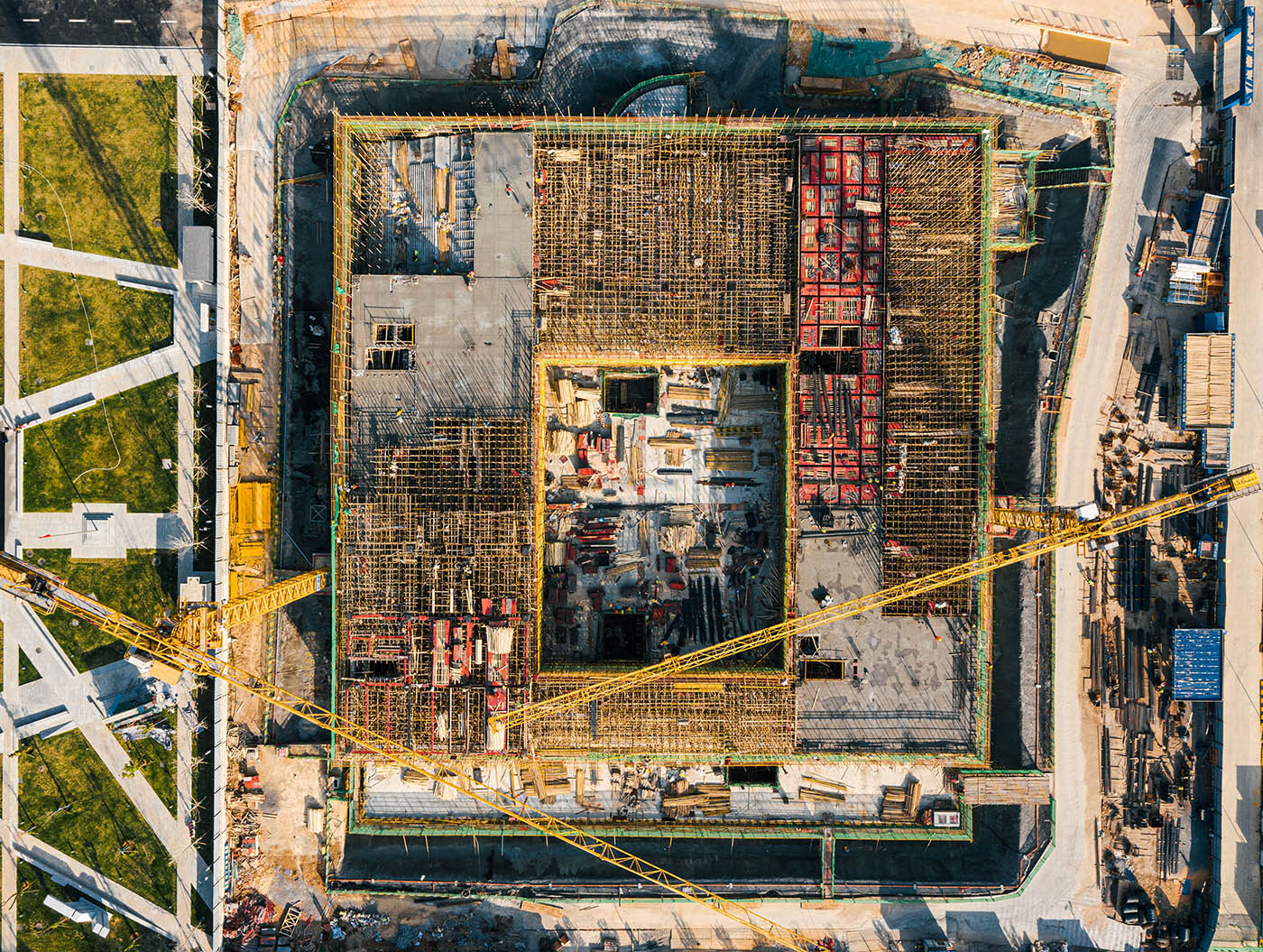
DRONE & GIS stands out by uniting drone technology with Geographic Information Systems (GIS) to offer advanced inspection and monitoring solutions. This combination generates a powerful synergy, maximising benefits for its Clients and Partners.

Quick access to elevated locations and uneven terrain, drastically reducing inspection time without the need for scaffolding.

The early detection of problems and the prevention of accidents result in a significant drop in the site's operational expenses..
Minimisation of accidents by eliminating human presence in working at heights or hazardous areas..

Management of physical progress and real-time monitoring of large-scale construction projects..

By eliminating the need for workers at dangerous heights or in hazardous environments, drones minimize accidents and increase safety on construction sites.

Provision of topographical maps, point clouds, and definitive digital twins for the proper long-term maintenance of the project..
