Innovation and Precision in Industrial Area Inspections
Aerial and ground inspection services are becoming increasingly sophisticated, offering a range of applications that go far beyond simply capturing data and images..
Equipped with high-tech sensors, such as thermal imaging cameras, ultrasound, and LiDAR, our equipment is capable of performing detailed and predictive analyses, identifying faults and anomalies before they become critical operational problems..
Essential Drones and Sensors for Inspections
Modern industrial inspection has evolved from manual, expensive, and risky processes to agile, precise, and safe operations, thanks to a sophisticated range of high-tech equipment. This revolution is led by different types of drones and robots, which act as versatile platforms for advanced sensors designed to diagnose the health of critical assets across global industry sectors.
Selecting the Right Equipment
Choosing the ideal combination of flight platform (drone) and payload sensor is crucial to the success of an inspection mission, whether finding a millimetric fault on a power tower, a gas leak in a refinery, or ensuring the structural integrity of a storage tank.
Our Drones: Platforms Adapted for Every Scenario
To ensure maximum precision in aerial inspections, selecting the flight platform is fundamental. Every project is unique, and choosing the ideal equipment considers critical factors such as the operating environment, distances, and asset characteristics. DRONE & GIS is equipped with the right technology to deliver tailored corporate solutions, meeting the needs of our clients and partners with excellence.
Multirotors (Quadcopters, Hexacopters)
MULTIROTOR DRONES
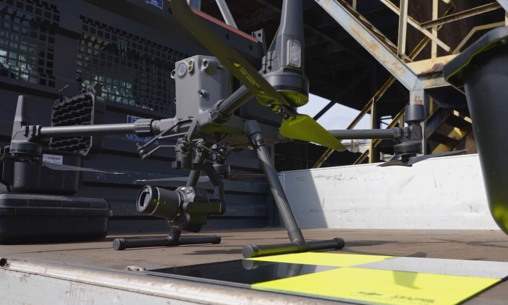
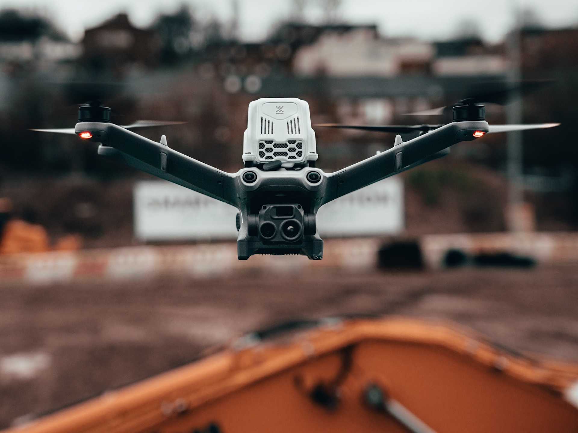
These are the most common in the industry, known for their stability, hovering capability, and manoeuvrability in restricted spaces, allowing close-proximity inspections with high precision.
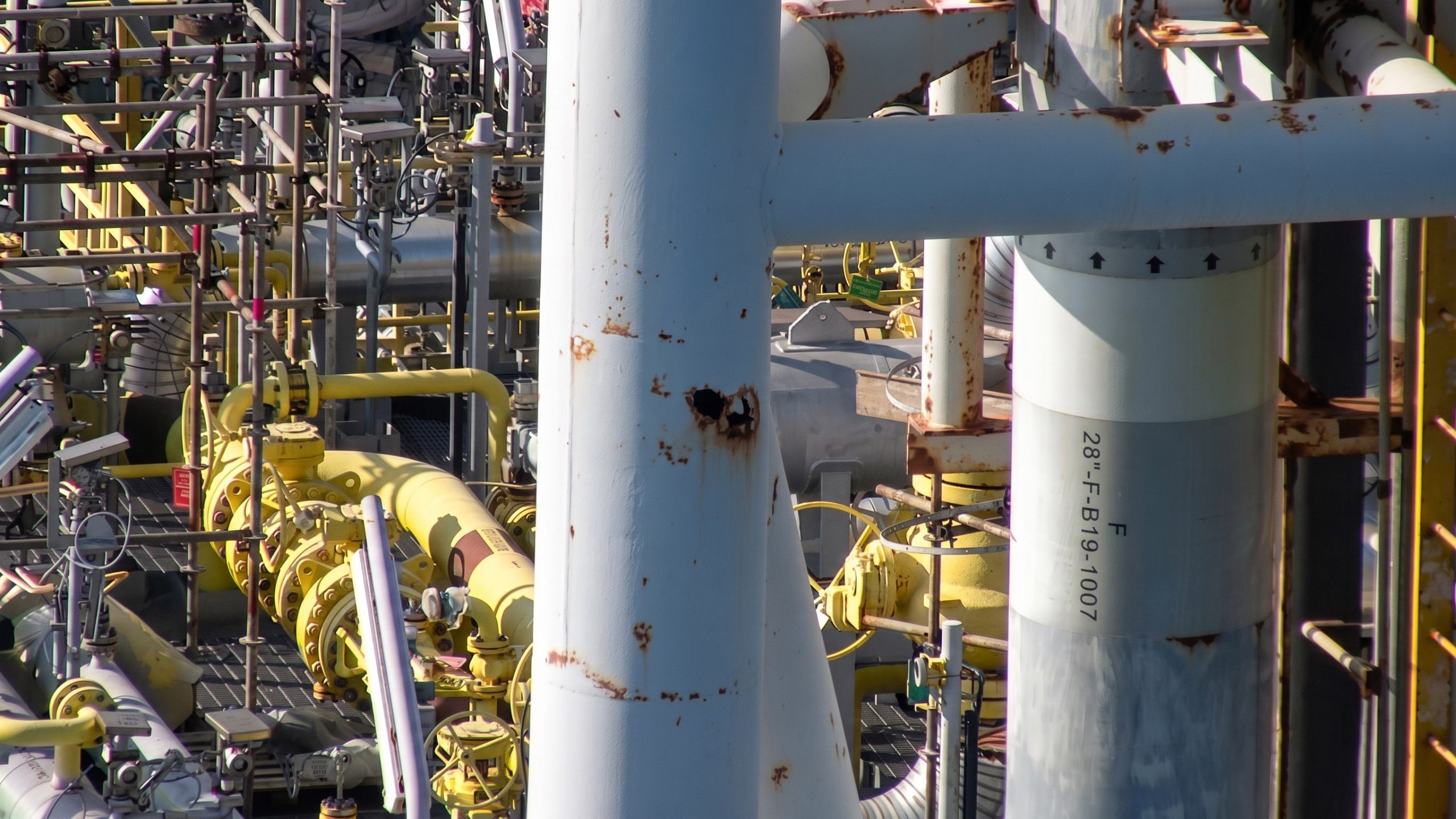
Typical Industrial Applications: Inspection of façades, roofs, flares, telecommunication and power towers, wind turbines, bridge structures, and viaducts.
VTOL DRONES
Combine the ability to take off and land vertically (like a multi-rotor) with the flight efficiency and endurance of a fixed-wing aircraft. They eliminate the need for runways, making them ideal for remote and hard-to-reach areas.
Typical Industrial Applications: Inspection of infrastructure corridors (railways, highways, transmission lines), environmental monitoring of large areas, and long-range missions from restricted points.
Vertical Landing and Takeoff
Caged Drones
CAGED / PROTECTED DRONES
Typical Industrial Applications: Internal inspection of storage tanks, boilers, pressure vessels, digesters, underground galleries, and ship holds, eliminating the need for human entry.
Typical Industrial Applications: Internal inspection of storage tanks, boilers, pressure vessels, digesters, underground galleries and ship stacks, eliminating the need for human entry..
Our Sensors: The Keen Senses of Aerial Inspection
The effectiveness of a drone inspection is defined by its payload sensor technology. At DRONE & GIS, we integrate the market's most advanced tools to ensure maximum reliability and detail in every operation:
High-Resolution RGB (Visual) Cameras with Zoom
Operate in the visible light spectrum with resolutions above 45 megapixels, capturing every detail with absolute clarity to identify cracks and corrosion. Combined with a hybrid zoom of over 200x, they perform detailed inspections without approaching risk areas, ensuring maximum safety and operational efficiency.
Thermal Imaging Cameras (Infrared)
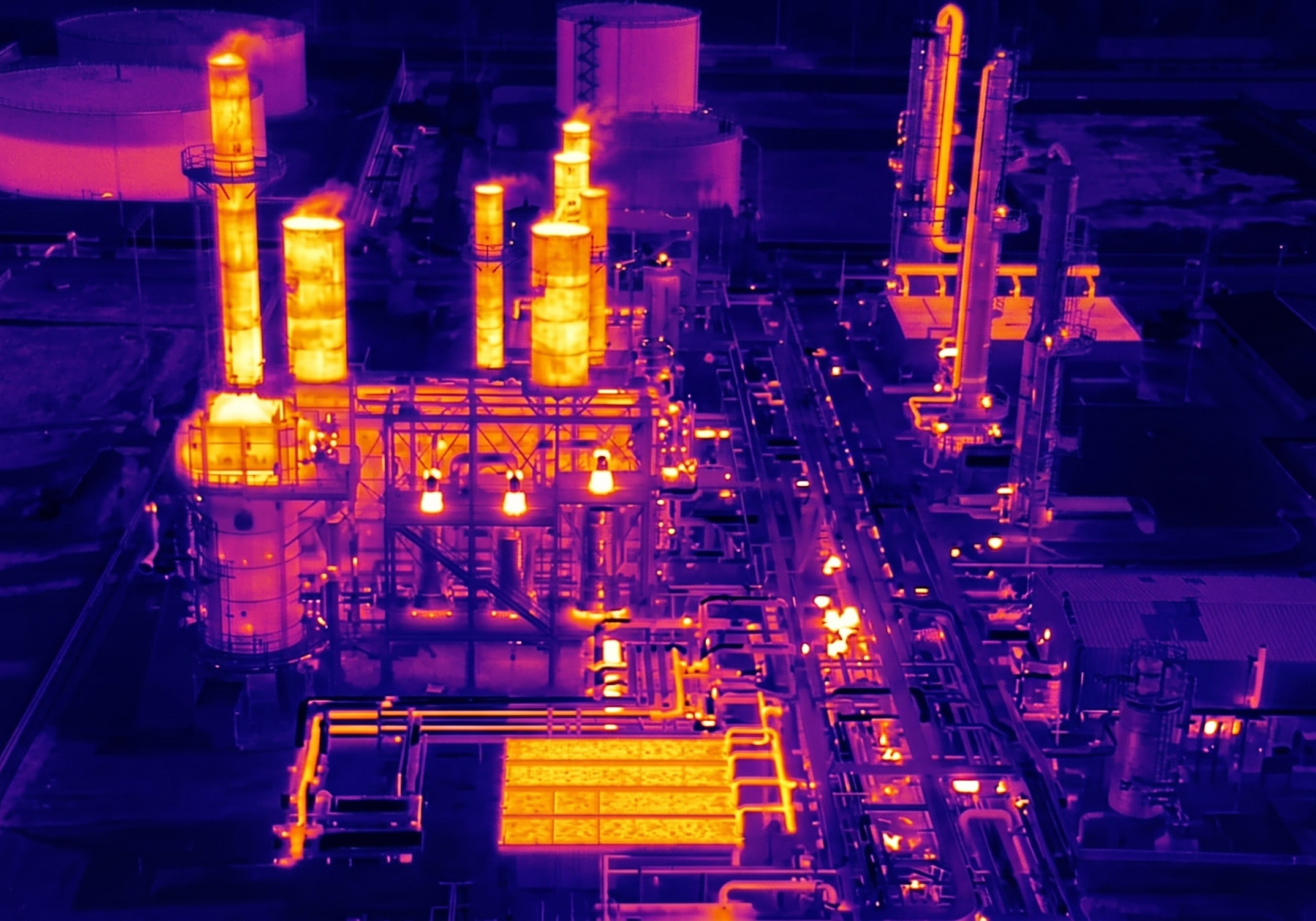
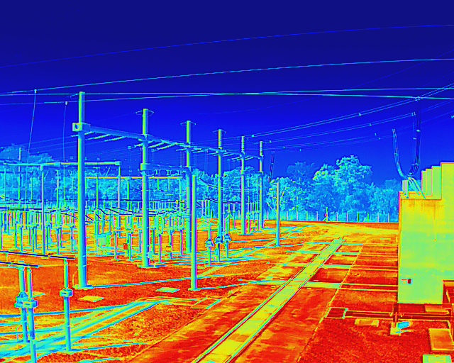
Convert invisible thermal energy into clear imagery, detecting minute temperature variations. Essential tools for predictive maintenance, diagnosing everything from transmission line overheating and solar panel faults to thermal losses in buildings.
LiDAR (Light Detection and Ranging) sensors
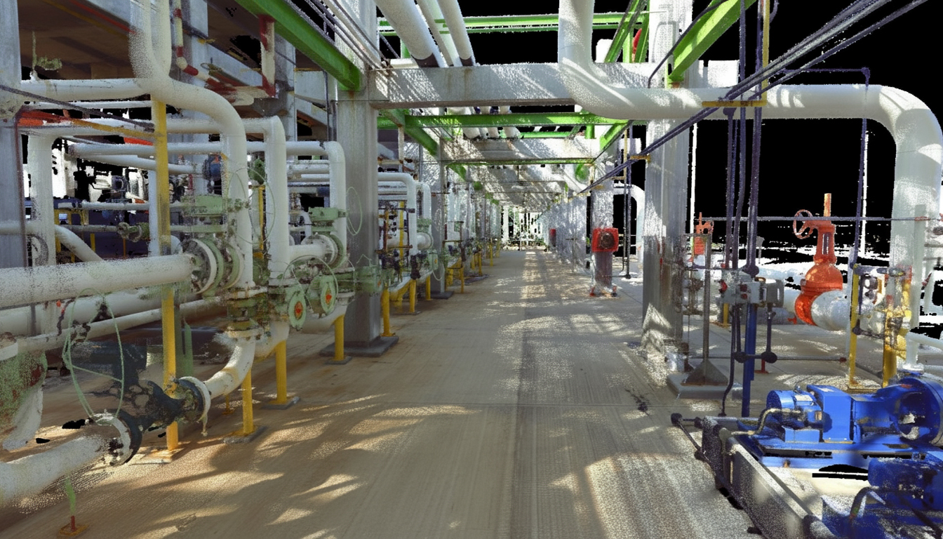
Transform physical environments or assets into precise three-dimensional models (Digital Twins). Laser scanning captures millions of measurement points, accurately calculating volumes, measuring exact clearance between cables and vegetation, and monitoring structural deformations.
Onboard Gas Detectors
High-sensitivity sensors, such as Tunable Diode Laser Spectrometers (TDLS), are integrated for remote detection and quantification of specific gases (e.g., methane and hydrogen sulphide). They enable real-time, georeferenced identification of leaks and fugitive emissions for immediate corrective actions.
SERVICES AND APPLICATIONS
Inspection of Equipment in Operation
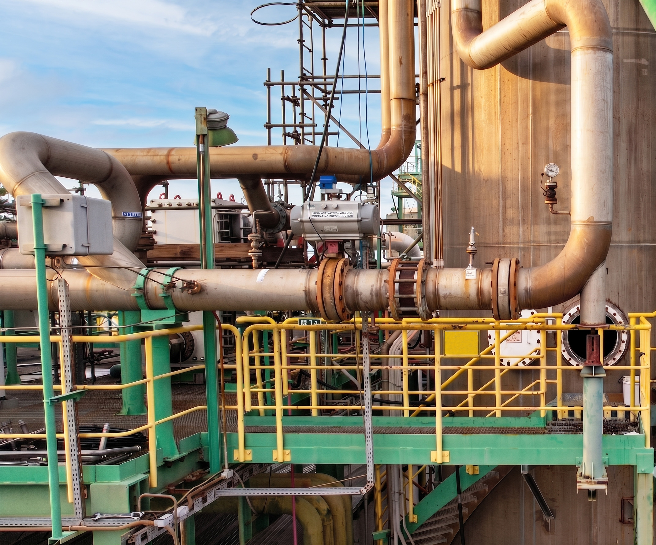
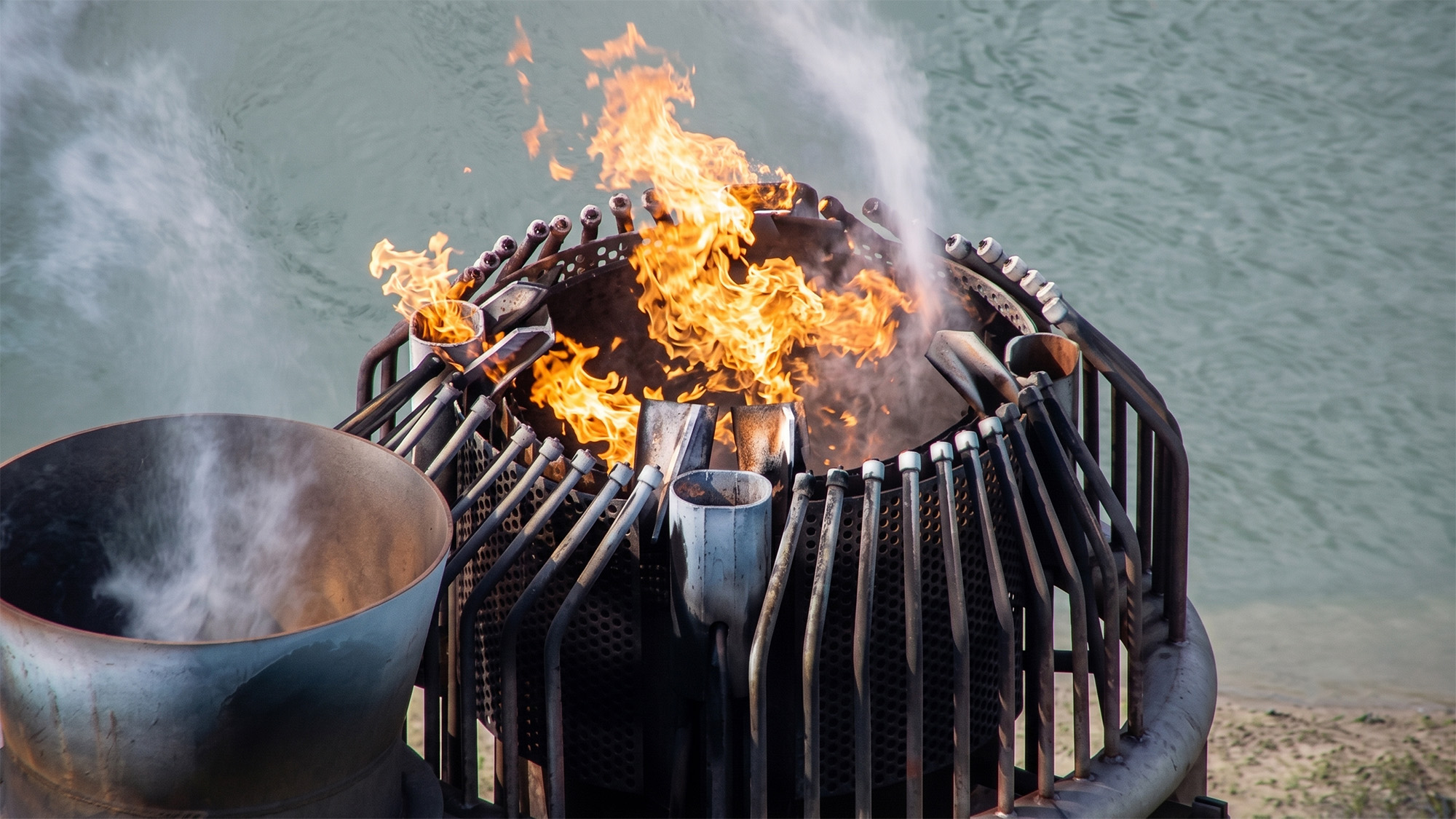
Monitoring storage tanks, pressure vessels, flares, and cooling towers. Technologies used include thermographic cameras to detect thermal insulation failures and Optical Gas Imaging (OGI) cameras to identify leaks invisible to the naked eye.
Electrical Infrastructure Inspection
Verification of substations, transformers, and internal plant power lines. Thermography identifies overheated connections (hotspots) indicating risk of electrical failure.
Plant Mapping and Modelling (Digital Twin)
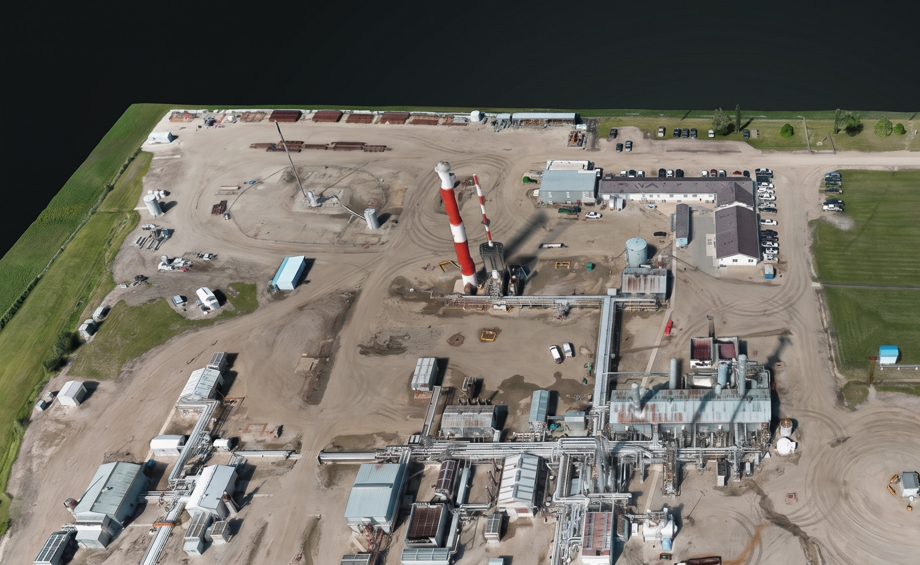
Creation of high-precision 3D models of the entire industrial plant via aerial photogrammetry and LiDAR sensors for maintenance planning, new facility simulations, and advanced asset management..
Aerial Inspection in Confined Spaces
What is Drone Inspection in Confined Spaces?
This solution uses drones specifically designed to fly inside industrial assets classified as confined spaces — locations not intended for continuous human occupancy, with restricted access and hazardous atmospheres. The main objective is to perform detailed visual inspections without human entry, eliminating risks associated with asphyxiation, poisoning, falls, and entrapment.
The Drone: A Purpose-Built Tool, Not a Standard Drone
For this type of application, the aircraft features exclusive high-tech capabilities:
The Drone is enclosed in a spherical frame (usually carbon fibre) that absorbs impacts. The equipment can collide with pipes and walls without losing stability, making navigation safe in complex environments.
As GPS signals are non-existent inside metal tanks or underground structures, these drones use a combination of sensors (such as optical, LiDAR, and SLAM) to map the environment and maintain stability in real time..
High-intensity lighting systems provide adjustable illumination to dark environments, preventing reflections on metal and allowing the camera to capture sharp images..
Equipped with 4K cameras to identify small cracks, corrosion, and defects in welds, as well as thermographic systems for detecting temperature anomalies..
Designed to fit through small openings and manholes, with diameters that generally do not exceed 40 cm.
Industries that benefit the most:
Fast and safe inspection of tanks, gas spheres, piping, and offshore platforms, eliminating scaffolding assembly and worker exposure to potentially explosive or toxic atmospheres.
Widely used in the inspection of thermal power plant boilers, wind turbine blades, hydroelectric power plant galleries and tunnels, as well as nuclear reactors, identifying cracks and defects without the need for prolonged maintenance shutdowns..
Underground mine surveys to assess ventilation shafts, galleries, and ore silos, ensuring structural integrity without endangering the teams..
Inspection is feasible in adverse conditions (high temperatures or heavy dust accumulation) in ducts, chimneys, and furnaces, providing detailed images for predictive maintenance..
Mapping optimizes the identification of obstructions, leaks, and structural damage in hard-to-see locations, such as sewer systems, storm drains, bridges, and overpasses..
Revolutionary Advantages
Human Safety Above All
This is the main benefit. The technology eliminates the need for human entry into a hazardous environment, eliminating the risk of serious or fatal accidents from falls, asphyxiation, gas poisoning, or being buried alive.
It also eliminates the stress and anxiety of workers who would be assigned to these dangerous tasks, meeting the highest safety standards and complying with regulatory norms.
Drastic Reduction in Costs and Downtime
A traditional inspection can take days or weeks and requires:
Scaffolding assembly is expensive and time-consuming.
Specialized teams for working at heights and rescue operations.
Extensive clearance and ventilation of the space.
With this technology, an inspection that would take 5 days can be completed in just a few hours. This means that the industrial asset is back in operation much faster, generating immense savings.
Superior Data Quality
The drone captures high-resolution images and videos from all angles, creating a complete and traceable digital record of the asset's internal condition. This allows for:
To identify problems that might go unnoticed by an inspector on scaffolding.
Create 3D models of the interior for more in-depth analysis.
Compare the asset's condition over time to monitor the evolution of pathologies.
Access to Previously Inspectable Locations
Technology allows us to reach points that would be extremely difficult or even impossible for a human being to inspect.
100% Coverage: The drone can fly and inspect high areas or areas with complex geometries where it would be impractical to erect scaffolding or reach safely.
Complete Diagnosis: Ensures a complete view of the asset's condition, without "blind spots" that could hide critical problems.
How We Can Help
Get in touch and schedule a consultation with our experts; it will be a pleasure to assist you!