Transportation – Ports

Digital Precision for the Port Infrastructure of the Future

Optimizing Operations, Mitigating Risks, and Maximizing Efficiency with Geospatial Intelligence and Cutting-Edge Aerial Photogrammetry

Revolutionizing Port Infrastructure with Geographic Intelligence

Applied Geospatial Intelligence

In a global landscape where supply chain efficiency and security are paramount, modern ports face complex challenges: from predictive maintenance of critical infrastructure and optimized asset management to ensuring perimeter security and compliance with stringent environmental regulations.

Our solutions are designed to provide a holistic and detailed view of operations, enabling highly accurate data-driven decision-making, resulting in significant reductions in operational costs, increased safety for teams, and maximization of asset lifespan.

Financial and Strategic Benefits

Cost Reduction with Predictive Maintenance

We replaced costly emergency repairs with planned and intelligent maintenance on critical assets (cranes, piers), optimizing budgets and minimizing operational downtime.

Exponential Increase in Operational and Human Safety

We eliminate the exposure of teams to hazardous work (heights, confined spaces) and proactively monitor the infrastructure to prevent accidents, protecting lives and port assets.

Data-Driven Decision Making

We replace subjectivity with precise data. Through digital models (Digital Twins), we offer managers a clear and complete view to make more assertive decisions about investments and operations.

Inspection and Predictive Maintenance of Critical Assets

Ensuring the Longevity and Reliability of Infrastructure with Precision Diagnostics.

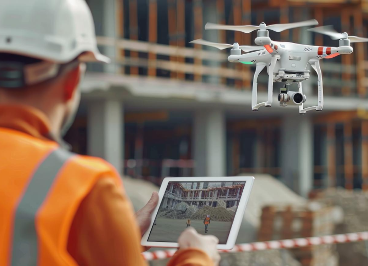
The structural integrity of cranes, docks, piers, breakwaters, and silos is vital. Our drones, equipped with ultra-high-resolution RGB sensors, thermal cameras, and LIDAR sensors, perform detailed inspections in hard-to-reach or high-altitude locations, eliminating the risks associated with human work and reducing equipment downtime.


Precision Structural Diagnosis (Metal and Concrete)

Using high-resolution imaging sensors, we perform a complete scan of the asset geometry, allowing for the early detection of critical structural pathologies. 

Our analyses identify and quantify corrosion (surface and pitting), fissures, cracks, concrete delamination, plastic deformation, weld integrity, and the condition of high-strength bolts. 

The targets include Port Cranes (STS, RTG, MHC), Shiploaders/Unloaders, and extensive conveyor belt structures. The final deliverable is a georeferenced technical report that maps the exact location of each anomaly onto the asset's 3D model, allowing maintenance teams to act with high precision.

Predictive Thermographic Analysis

Heat is often the first indicator of an impending failure in electromechanical systems. 

Our radiometric thermographic sensors capture precise temperature data, identifying anomalies that are invisible to the naked eye. We perform inspections on electrical panels, substations, large motors, conveyor belt bearings, and crane traction systems. 

Identifying hot spots, overloads, or phase imbalances allows maintenance to intervene proactively, replacing components before catastrophic failure and preventing downtime that can cost millions in operational losses.

3D Modeling and Digital Twins in Engineering

We transform visual inspections into engineering data. By fusing LIDAR point cloud data and photogrammetry, we create highly accurate three-dimensional models. These models are not just visual representations; they are intelligent metric tools for: 

  • Strain and Verticality AnalysisCompare the asset's condition over time to monitor settlement or warping.
  • Retrofit and Modernization PlanningSimulate the installation of new components, ensuring compatibility and avoiding interference (clash detection).
  • Precise Calculation of QuantitiesCalculate exact areas for blasting and painting services or structural repair volumes, dramatically optimizing maintenance budgets.

MAPPING, BATHYMETRY AND PRECISION TOPOGRAPHY

The Cartographic Base for Intelligent Management and Port Expansion.

The planning, operation, and expansion of a complex port infrastructure depend on an accurate and up-to-date geospatial representation of the terrestrial and underwater environment. DRONE & GIS establishes this digital foundation through the fusion of aerial photogrammetry data, laser profiling (LIDAR), and bathymetric surveys. We generate a continuous and integrated model of the port, which serves as the cartographic basis for all engineering projects, siltation monitoring, berth management, and logistics optimization, constituting the fundamental layer of the port's Digital Twin.

Digital Aerial Surveying and Asset Mapping

Through systematic scanning with drones equipped with geodetic positioning systems (GNSS RTK/PPK), we achieve centimeter-level precision in all our topographic surveys. The resulting products are essential for engineering and management:

  • Ultra-High Resolution OrthophotosMosaics of georeferenced images that serve as a detailed visual basis for asset registration, identification of pavement pathologies, signage planning, and yard area management. 
  • Digital Surface Models (DSM) and Digital Terrain Models (DTM)Accurate 3D representations of topography, crucial for drainage studies, earthwork projects, cut/fill volume calculations, and visibility analysis for safety systems.

High-Frequency Bathymetric Surveys

Ensuring the correct operational draft is vital for the safety and efficiency of navigation. Using echo sounders integrated into drones or autonomous surface vehicles (ASVs), we perform precise monitoring of the depth of access channels, turning basins, and mooring areas.

The result is Digital Bathymetric Models (DBMs) and detailed isobath charts, which allow the transition from a reactive dredging model to proactive management, identifying critical siltation zones and enabling "precision dredging" campaigns, optimizing costs and minimizing environmental impact.

Digital Inventory Measurement and Volumetric Management

Controlling the inventory of solid bulk materials is a logistical and financial challenge. By applying LIDAR or photogrammetry techniques, we generate dense point clouds of material stockpiles (ores, grains, coal, etc.) to create accurate 3D models. From these, we calculate volumes with an accuracy greater than 99%.

This fast and secure method provides auditable data for inventory balances, invoicing, loss control, and logistics planning, allowing for high-frequency measurements (daily or weekly) that reflect the real dynamics of the storage yard.

Property Security and Intelligent Surveillance

Multiplying Security Efficiency and Ensuring Regulatory Compliance

Modern port security demands a proactive and technologically advanced approach. DRONE & GIS implements a layer of aerial Intelligence, Surveillance, and Reconnaissance. Our solutions go beyond simple observation, integrating with the Operational Control Center (OCC) to provide comprehensive, real-time situational awareness. Using drones with extended autonomy and long-range optical sensors for immediate and automated response, we create a persistent surveillance dome over critical infrastructure.

Intelligent Perimeter Monitoring and Threat Detection

We provide continuous surveillance of complex perimeters, both terrestrial (fences, walls, gates) and aquatic (channel boundaries, anchorage areas).

Our drones are equipped with embedded Artificial Intelligence (AI) algorithms for real-time video analysis, capable of autonomously detecting, classifying, and tracking targets of interest (people, vehicles, unauthorized vessels).

Upon detecting a breach, the system automatically sends alerts to the CCO (Central Control Center), with the exact coordinates and video stream of the target, allowing for a targeted, rapid, and informed response from the ground team.

Rapid Incident Response and Crisis Management (Hazmat)

In emergency situations, every second counts. Our drones are the first unit on the scene, providing critical intelligence without risking human lives.

In the event of fires, radiometric thermographic sensors identify heat sources, assess the structural integrity of warehouses, and guide firefighting teams along safe routes.

In hazardous materials (Hazmat) incidents, drones delineate the spill area, monitor the dispersion of toxic clouds, and inspect the source of the spill, providing vital data to containment teams. This ability for immediate assessment speeds up decision-making and minimizes the impact of the incident.

Operational Intelligence and Yard Inspection

We extend surveillance to include inspection and ensuring operational compliance on the aprons. Our high-resolution aerial systems perform detailed inspections to:

  • Seal VerificationRemote inspection of container seals in high stacks, ensuring cargo integrity. 
  • Monitoring of Hazardous CargoSurveillance of IMO cargo storage areas, ensuring compliance with safety distances and procedures. 
  • Security AuditIdentification of operational non-conformities, such as improper stacking of containers, obstruction of emergency routes, or unauthorized personnel access to restricted areas.

ENVIRONMENTAL MONITORING AND REGULATORY COMPLIANCE

Transforming Environmental Data into Intelligence for Sustainable Management and Regulatory Advocacy

A social and environmental license to operate is one of a port's most valuable assets. DRONE & GIS offers an environmental monitoring platform that transforms regulatory obligations into proactive and intelligent data management. Our solutions generate a digital, georeferenced, and multi-temporal environmental dossier, providing auditable, traceable, and defensible data for environmental agencies. We systematize data collection and analysis to ensure compliance and strengthen sustainability practices and ESG (Environmental, Social, and Governance) reporting.

Water Quality Monitoring and Dredging Operations

During dredging operations, turbidity plume control is a critical requirement for environmental permits. We use multispectral sensors to map and quantify sediment dispersion in real time, generating accurate reports that prove adherence to established limits. 

Furthermore, our technology allows for the identification of anomalies in water quality, such as chlorophyll-a concentration (indicative of eutrophication or algal blooms), and the monitoring of effluents. 

We also employ drones equipped with collection systems for water sampling in hard-to-reach locations, ensuring a comprehensive and safe monitoring program.

Multitemporal Analysis of Ecosystems and Coastal Morphology

The resilience of the port is intrinsically linked to the health of the adjacent ecosystems. We carried out detailed mapping of sensitive habitats, such as mangroves, coastal vegetation, and dunes.

Through multitemporal analysis (comparing surveys over time), we use vegetation indices (e.g., NDVI) to assess vegetation health, density, and suppression, detecting signs of environmental stress.

Additionally, we monitor coastal morphology, mapping beach profiles and shorelines to quantify erosion or deposition processes, providing crucial data for coastal protection projects and for assessing the impact of structures such as breakwaters.

Detection and Rapid Response to Leaks and Pollutants

In the event of a spill of hydrocarbons or other chemicals, a rapid response is crucial to mitigating the impact. 

Our drones, equipped with a suite of sensors that includes thermal, ultraviolet (UV), and polarized light cameras, are able to detect and pinpoint the exact extent of the oil spill with high precision, even in thin layers of water. 

We provide actionable, real-time intelligence to containment teams, including calculating the area of the oil spill, monitoring its drift under the effect of winds and currents, and identifying the most vulnerable coastal areas, optimizing the placement of barriers and skimmers for a more effective response.