In an energy market defined by the need for maximum efficiency and availability, wind asset management has evolved beyond reactive maintenance.
A DRONE & GIS It offers a cutting-edge solutions platform that integrates multi-sensor UAS (Drone) systems, precision geotechnologies (LiDAR/GIS), and Artificial Intelligence frameworks (Deep Learning) to provide a predictive and unified view of your portfolio.
Our mission is to convert high-fidelity engineering and inspection data into actionable intelligence, optimizing Levelized Cost of Energy, maximizing Annual Energy Production, and ensuring the perpetuity of your onshore and offshore assets.
Risks and efficiency of high-altitude inspection
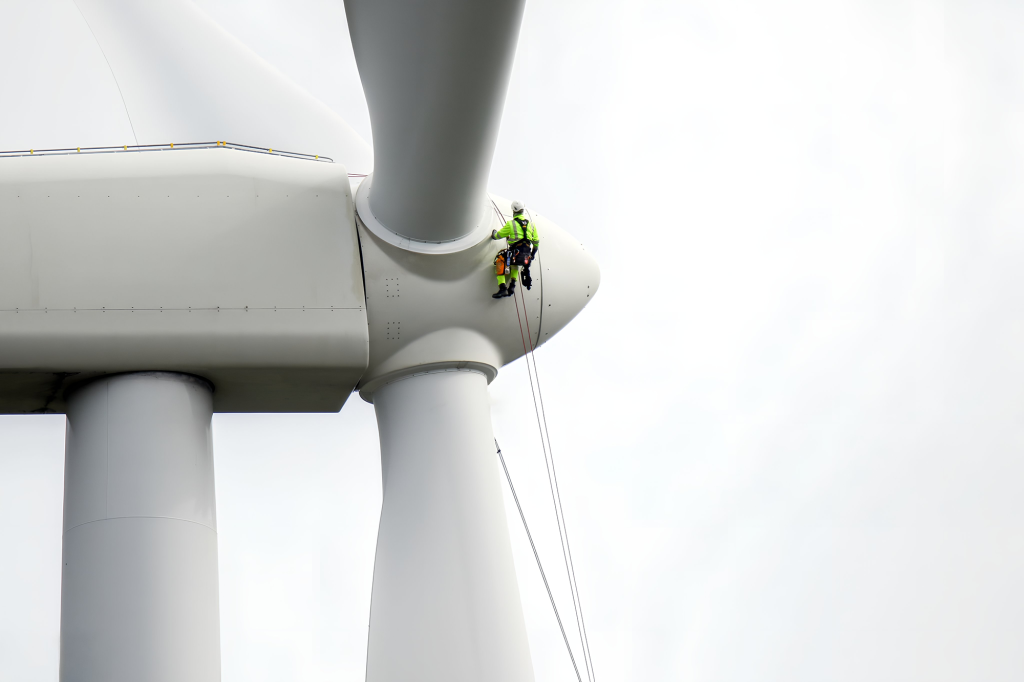
The Critical Challenge of Working at Heights
Inspections of wind turbine blades traditionally require complex operations at high altitudes, putting the safety of the teams at risk.
The Importance of Early Detection
Timely detection of degradation is crucial to prevent small defects from escalating into critical failures, ensuring the safety and profitability of the asset.
Extend the useful life of your assets.
Proper, data-driven maintenance transforms asset management. Predictive interventions prevent further degradation, protecting the turbine's most critical component and ensuring its continued operational viability.
Aerial Photogrammetry with Ultra-High Resolution RGB Sensors
Our approach merges geospatial intelligence with structural integrity and operational throughout the entire asset lifecycle, from greenfield and Commissioning through repowering and decommissioning.
Geospatial Engineering and CAPEX Optimization
The economic viability and efficiency of a wind farm are defined by its geospatial foundation.
Our remote sensing solutions provide the essential data baseline for detailed engineering, construction, and project financing.
Precision Surveying and Digital Twins (LiDAR & Photogrammetry)
We build the baseline of your project, capturing reality with LiDAR point clouds and high-density photogrammetry. These models (DTM/DEM) are the foundation of your engineering, allowing you to:
Micrositing and AEP OptimizationPrecise turbine placement based on real topography to maximize energy capture and validate wind flow models (pre-CFD).
Civil CAPEX OptimizationPrecise planning of earthworks (cut/fill) and the design of access roads and platforms, ensuring minimum costs and logistical feasibility for large components.
We deliver complete digital modeling of your interconnection assets and plant balance. Using aerial and ground-based LiDAR, we create Digital Twins of the network that model the catenary (as-built) with centimeter precision.
This approach proactively mitigates the risks of shutdowns due to vegetation encroachment and ensures regulatory compliance, protecting your revenue against unscheduled downtime.
Most crucially, these high-fidelity models are the technical basis for capacity increase and reconductor studies, ensuring that your flow infrastructure does not become a bottleneck for the park's maximum Annual Energy Production.
Intelligence and Optimization of Transmission Corridors
Hydrological Modeling and Flood Risk
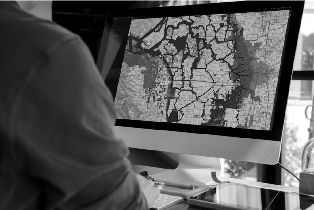
Using high-precision Digital Elevation Models (DEMs) obtained by LiDAR and integrating them with rainfall and watershed data in a GIS environment, we performed hydrological modeling.
We precisely mapped the areas susceptible to flooding (river and rain), surface runoff, and areas of soil saturation.
This analysis is crucial for the safe positioning of foundations, substations, and access roads, mitigating the risks of water erosion and ensuring the project's resilience to extreme weather events.
The integrity of the foundation is the anchor of the entire wind asset. Our approach to geotechnical risk management goes beyond point-in-time analysis. We have built a dynamic geodatabase that integrates data from multiple sources to create a robust predictive model of geographic risks.
Morphometric Data (derived from LiDAR/DTM)We extracted critical parameters such as slope, aspect (terrain orientation), and curvature, which are direct proxies for slope instability and erosion processes.
Geological and Lithological DataMapping of soil units (type, thickness) and rock, structural faults and geological lineaments that control substrate resistance.
Hydrogeological and Hydrological Data: Modeling of groundwater flow, water tables, and soil saturation, which directly impact pore pressure and soil stability (shear strength).
Ground Deformation Data (InSAR): Use of satellite radar time series (Interferometry) to monitor millimeter-level deformations of the terrain (subsistence, differential settlement or slope creep) even before installation, identifying areas of latent instability.
Advanced Geotechnical Risk Management
Asset Integrity and Predictive Intelligence
Our asset integrity management replaces traditional manual inspection, which is inherently subjective, high-risk, and has low repeatability, with secure and fully automated massive data acquisition campaigns.
We created an objective digital baseline for each asset, enabling the transition from reactive/preventive maintenance to a purely predictive framework.
High-Fidelity Multi-Sensor Data Acquisition
Our autonomous drones execute pre-programmed flight plans that ensure optimized image overlap and a constant distance from the asset surface. This ensures standardized and repeatable data acquisition.
Ultra-High Resolution Visual Inspection (RGB)Equipped with full-frame sensors, we achieve a millimeter-level GSD (Ground Sample Distance). This allows for the detection of microcracks, porosity, pinholes, and the initial stages of damage that would be undetectable by visual inspections from a distance or with lower-resolution sensors.
Radiometric Thermography (IR)Our radiometric thermal sensors don't just capture a heat image; they measure the absolute temperature of tens of thousands of points per image (pixel by pixel). This is crucial for quantifying, not just qualifying, anomalies.
The greatest risk in composites (such as wind turbine blades) lies in what cannot be seen. Our thermographic data, when analyzed by experts in Non-Destructive Testing, reveal anomalous thermal signatures caused by differential heat dissipation.
This allows us to accurately identify critical subsurface pathologies such as:
Delamination (separation of the composite layers).
Moisture infiltration.
Air bubbles.
Structural adhesion failures (e.g., shear web detaching from the blade's outer layer).
These anomalies are the main precursors to catastrophic structural failures, such as blade rupture.
Detection of Latent (Subsurface) Structural Pathologies
Identifying Anomalies with Artificial Intelligence (AI)
Computer Vision and Deep Learning
Inspecting a single wind farm generates terabytes of raw data, a vast amount of data that makes manual analysis not only inefficient but fundamentally unfeasible at scale. Human inspection is susceptible to fatigue, cognitive bias, and lack of standardization, leading to inconsistent results and undetected risks.
Our Deep Learning architectures, including Convolutional Neural Networks for classification and Fully Convolutional Networks for segmentation, automate and scale this analysis with superhuman precision and objectivity. Our models are trained on massive, heterogeneous datasets, annotated by experts in Non-Destructive Testing and materials engineers.
Decision Support System and Fundamentals for Forecasting
The output is not a static report; it's a Support System. Dynamic decision-making.
We removed the inspector's subjectivity, handing it over to the manager. From O&M, a dashboard with a prioritized work list., based on real risk.
This allows for the surgical allocation of repair resources (OPEX)., focusing teams and campaigns only where the risk of failure is imminent or economically significant.
By tracking the growth rate of specific anomalies to Throughout successive inspections (timeline analysis), our The platform establishes the essential foundation for the analysis of forecasts, allowing for future estimates of Useful Life Remnant of the component.
Operational Optimization
Minimize unscheduled downtime and reduce your O&M costs. Our Asset intelligence solutions ensure maximum Annual Production of Energy and implement the foundation for maintenance management. completely predictive.
Asset Integrity and Predictive Intelligence
Our asset integrity management replaces traditional manual inspection, which is inherently subjective, high-risk, and has low repeatability, with secure and fully automated massive data acquisition campaigns.
We created an objective digital baseline for each asset, enabling the transition from reactive/preventive maintenance to a purely predictive framework.
Decision Support System and Fundamentals for Forecasting
The output is not a static report; it's a Support System. Dynamic decision-making.
We removed the inspector's subjectivity, handing it over to the manager. From O&M, a dashboard with a prioritized work list., based on real risk.
This allows for the surgical allocation of repair resources (OPEX)., focusing teams and campaigns only where the risk of failure is imminent or economically significant.
By tracking the growth rate of specific anomalies to Throughout successive inspections (timeline analysis), our The platform establishes the essential foundation for the analysis of forecasts, allowing for future estimates of Useful Life Remnant of the component.